11:46 am
Applications, DL Exclusive, Drone, drone mapping, Drone News Feeds, DroneDeploy, ground mapping, mapping for construction, News, photogrammetry
DroneDeploy’s New Products: company launches mapping, inspection and ground-based robot products By Jim Magill Drone software company DroneDeploy unveiled a suite of new products, allowing customers to virtually walk through construction sites, capture and process data across miles of pipelines or electric transmission lines, and control walking inspection robots from …
Read More »
6:38 pm
Drone, drone data, drone LiDAR, drone mapping, Drone News Feeds, drone photogrammetry, LIDAR, News, photogrammetry, SimActive
Drone-based mapping and LiDAR are a powerful combination. Now, Canada’s SimActive Inc., a leading developer of photogrammetry software that can accommodate aerial imagery from satellite, manned aircraft, or drones, announces the integration of its Correlator3D™ product into LiDAR systems for drones developed by LiDAR USA. LiDARUSA, also known as Fagerman Technologies, …
Read More »
7:47 pm
correlator3d, Drone, drone mapping, Drone News Feeds, photogrammetry, SimActive
SimActive‘s new version of Correlator 3D, version 8.6, is feature-rich – making mapping from aerial images easier and more accurate all the time. Canada’s SimActive is a photogrammetry software that began as a solution for aerial images from satellite and manned aircraft. The inclusion of drone data in the solution …
Read More »
11:45 am
Drone, Drone News Feeds, ground images for photogrammetry, News, photogrammetry, Pix4D, Pix4dcatch
In a sign that the drone industry has reached a new phase in its evolution, drone companies are moving beyond drones. Photogrammetry solution provider Pix4D has launched Pix4Dcatch, a new app for getting ground images from iOS devices like iPads and iPhones. The new app means that operators can use …
Read More »
6:07 pm
Applications, Construction, Drone, drone mapping, Drone News Feeds, DroneDeploy, DroneDeploy conference, Mike Winn, News, photogrammetry
At this week’s DroneDeploy conference, DroneDeploy co-founder Mike Winn says that despite the challenges of 2020, the future of drone mapping, and the drone community, is here. In an opening address, Winn presented a fascinating view of the worksite of the future, using the construction industry as an example. “Almost …
Read More »
7:45 pm
commercial drone survey, corridor surveying, Drone, Drone News Feeds, drone surveying, Featured - Surveying, News, photogrammetry, Pix4D, Pix4Dmatic, Survey, Surveying
As mapping professionals are called on to map larger and larger areas around the world, photogrammetry software is evolving to meet their needs. Today, Pix4D announces PixDmatic: faster, accurate photogrammetry on a larger scale. “Projects that would have previously been mapped by aircraft are now being surveyed with drones,” says …
Read More »
9:04 pm
Aerospace, Agriculture, Applications, Auto, Business and Finance, Chemical, Construction, Defense, Delivery, Drone, Drone News, Drone News Feeds, Education, Entertainment, georeferenced survey-grade, Healthcare, Insurance, Journalism, Media, Mining and Aggregates, Mining and Construction, News, Pharmaceutical, photogrammetry, Pix4D, Real Estate, Sponsored Content, Telecommunications
Pix4D launches stand-alone photogrammetry cloud processing solutions Lausanne, Switzerland, June 9th, 2020: Pix4D, the photogrammetry and drone-mapping industry leader, announces today the release of Pix4Dcloud and Pix4Dcloud Advanced: the new mapping platforms for online surveying workflows and construction site monitoring. These stand-alone cloud products run Pix4D’s photogrammetry algorithms for mapping and modeling reality from images. …
Read More »
4:07 pm
3D modeling, Bobby Oeyang, Drone, Drone News Feeds, drones and 3D modeling, Feature 1, News, photogrammetry, SkyeBrowse, videogrammetry
The rise of videogrammetry is enabling 3D modeling for everyone: making the process easier and lowering barriers to adoption. The following is a guest post by Bobby Ouyang, CEO of SkyeBrowse. SkyeBrowse is an innovative software that enables 3D modeling through videogrammetry. DRONELIFE neither accepts nor offers payments for guest …
Read More »
10:02 am
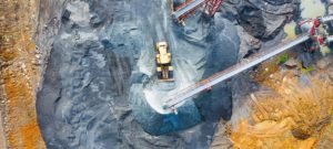
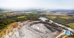
Applications, correlator3d, Drone, Drone News, Drones in the News, Featured - Business, Featured - Mining, Featured - Surveying, Mining, Mining and Aggregates, Mining and Construction, News, orthomosaics, photogrammetry, SimActive
From Simactive Canadian mapping software company SimActive has added additional capacity to be able to automatically assess multiple volumes of material (aggregates and other material) for projects and to report based upon the findings. If the same area is being flown, users can then compare the volumes and access differences …
Read More »
10:09 am
Alietum Ltd., commercial drone software., Correlator 3D, Drone, drone mapping, Drone News Feeds, drones in mining, Featured - Mining, mining drones, News, photogrammetry, SimActive
SimActive Inc. is a world-leading developer of photogrammetry software – for drones and for manned aircraft. It’s a professional tool that provides the speed and precision big business expects. SimActive’s Correlator 3D software takes data from any sensor and uses one software interface for processing. Now, SimActive introduces new features …
Read More »