9:46 pm
Drone, Drone News, Drone News Feeds, Drones in the News, Featured - Surveying, News
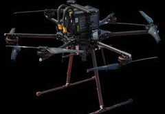
Inspired Flight and Phase One Announce New Integrated Solution by DRONELIFE Staff Writer Ian M. Crosby Commercial sUAS manufacturer Inspired Flight Technologies and aerial photography system developer Phase One have announced the launch of a new plug and play solution which integrates the Inspired Flight IF1200A and the Phase One …
Read More »
5:08 pm
DL Exclusive, Drone, Drone News, Drone News Feeds, Drones in the News, Feature 1, Featured - Surveying, News
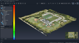
This week, SimActive launches v10 of Correlator3D: a new, feature-rich and redesigned version of SimActive’s innovative mapping platform. The company is also celebrating 20 years – a major achievement in any industry. DRONELIFE spoke with brothers Philippe and Louis Simard, the visionary team behind a mapping product used …
Read More »
7:29 pm
Drone, Drone News, Drone News Feeds, Featured - Surveying, News, Survey, Surveying
Event 38 and PLACE Partner to Map Turks and Caicos Islands Using E400 Drones by DRONELIFE Staff Writer Ian M. Crosby Mapping drone manufacturer Event 38 Unmanned Systems has announced the successful deployment of its E400 fixed-wing mapping drone for the collection of aerial imagery and mapping data in Turks …
Read More »
3:28 pm
Drone, Drone News, Drone News Feeds, Drones in the News, Featured - Surveying, News, Products, Sensors
Gremsy announces the launch of the Pixy S gimbal for Sony A7R IV The new Gremsy Pixy S, an innovative industrial gimbal designed for the Sony A7R IV, will be available this month from Gremsy’s online store and through the company’s worldwide network of dealers. The new Pixy S is …
Read More »
12:02 am
Aloft, commercial drone inspections, Drone, Drone News Feeds, Featured - Surveying, Inspection, News, Skydio, Skydio Cloud, Skydio data
Skydio and Aloft Introduce Data Integration for Enterprise Customers by DRONELIFE Staff Writer Ian M. Crosby Today, Aloft Technologies, alongside autonomous flight leader Skydio, announced a newly available integration between Aloft Air Control for Enterprise and Skydio Cloud. This new integration provides customers with a united, reliable data stream of …
Read More »
6:45 pm
3d mapping, Applications, Drone, Drone News, Drone News Feeds, Drones in the News, F90+ Trinity drone, Featured - Surveying, mapping drone, News, Propeller Aero, Quantum-Systems, Surveying
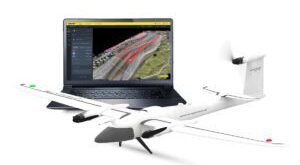
Quantum-Systems Partners with Propeller Aero: Trinity F90+ Drone and Propeller Aero’s 3D Mapping Software by DRONELIFE Staff Writer Ian M Crosby Trimble [NASDAQ:TRMB] is one of the holdings in the AdvisorShares Drone Technology ETF [NYSE ARCA:UAV], the only ETF dedicated to the drone economy. The AdvisorShares Drone Technology ETF is …
Read More »
9:42 pm
DL Exclusive, Douglas Spotted Eagle, Drone, drone mapping, Drone News Feeds, drone surveying, Feature 1, Featured - Surveying, News, non-RTK aircraft, Products, rtk, Sensors, Sundance Media, Sundance Media Group
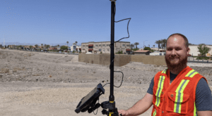
Real-Time Kinematic (RTK) is a buzz term in the UA industry, one many pilots may not understand, even though they may be “mapping” with an uncrewed aircraft (drone). When it comes to RTK and drone mapping, how necessary is the technology to a drone services provider? Will it earn …
Read More »
5:18 pm
Drone, Drone Education, Drone Jobs, Drone News Feeds, drones in GIS, drones in mapping, Featured - Surveying, News, Sponsored Content, USC GIS, USC Spatial Sciences Institute
The University of Southern California Spatial Sciences Institute offers flexible, online degree and certificate programs that provide the education -and the respected credentials – required to succeed in using drones for GIS mapping. Read on to learn more about how the University of Southern California is helping to shape the …
Read More »
7:45 pm
commercial drone survey, corridor surveying, Drone, Drone News Feeds, drone surveying, Featured - Surveying, News, photogrammetry, Pix4D, Pix4Dmatic, Survey, Surveying
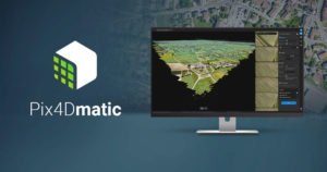
As mapping professionals are called on to map larger and larger areas around the world, photogrammetry software is evolving to meet their needs. Today, Pix4D announces PixDmatic: faster, accurate photogrammetry on a larger scale. “Projects that would have previously been mapped by aircraft are now being surveyed with drones,” says …
Read More »
10:02 am
Applications, correlator3d, Drone, Drone News, Drones in the News, Featured - Business, Featured - Mining, Featured - Surveying, Mining, Mining and Aggregates, Mining and Construction, News, orthomosaics, photogrammetry, SimActive
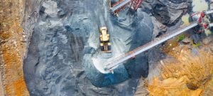
From Simactive Canadian mapping software company SimActive has added additional capacity to be able to automatically assess multiple volumes of material (aggregates and other material) for projects and to report based upon the findings. If the same area is being flown, users can then compare the volumes and access differences …
Read More »