9:42 pm
DL Exclusive, Douglas Spotted Eagle, Drone, drone mapping, Drone News Feeds, drone surveying, Feature 1, Featured - Surveying, News, non-RTK aircraft, Products, rtk, Sensors, Sundance Media, Sundance Media Group
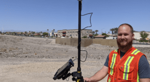
Real-Time Kinematic (RTK) is a buzz term in the UA industry, one many pilots may not understand, even though they may be “mapping” with an uncrewed aircraft (drone). When it comes to RTK and drone mapping, how necessary is the technology to a drone services provider? Will it earn …
Read More »
6:20 pm
aerial photographers, Drone, Drone News Feeds, drone surveying, Feature 1, first amendment rights, News, Surveying
Is drone mapping surveying without a license? A First Amendment lawsuit in North Carolina says surveyors cannot stop drone operators from selling photos and making maps. Hiring a surveyor is an expensive buisness, but necessary if you want to establish legal property lines. What if you just want to see …
Read More »
3:59 am
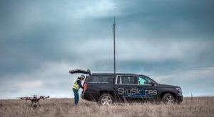
coronavirus, Drone, Drone News, Drone News Feeds, drone surveying, Inspection, inspection drones, SkySkopes
Source: SkySkopes As industries across the globe come to grips with the “new normal” of a COVID-19 challenges, drone service providers (DSP) are launching new levels of innovation across a range of public and commercial sectors. Last year, Barclays projected drones will lower costs by $100 billion across a majority …
Read More »
7:45 pm
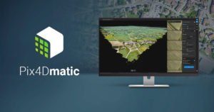
commercial drone survey, corridor surveying, Drone, Drone News Feeds, drone surveying, Featured - Surveying, News, photogrammetry, Pix4D, Pix4Dmatic, Survey, Surveying
As mapping professionals are called on to map larger and larger areas around the world, photogrammetry software is evolving to meet their needs. Today, Pix4D announces PixDmatic: faster, accurate photogrammetry on a larger scale. “Projects that would have previously been mapped by aircraft are now being surveyed with drones,” says …
Read More »
11:27 pm
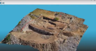
Applications, Down to Earth, Drone, drone surveying, Featured - Surveying, Microdrones, Microdrones GmbH, Mining and Aggregates, Mining and Construction, Real Estate
We here at DRONELIFE are as vulnerable as anyone else to the joys of reality TV, so we were pleased to see that drone provider Microdrones is scheduled to release a reality TV styled video webinar series named Down to Earth. The idea is to show the challenges and hazards that surveying …
Read More »
11:32 am
3d mapping, agriculture drone, Applications, Drone, drone cameras, drone surveying, Featured - Agriculture, Featured - Products, Featured - Surveying, Imaging, jeff Fagerman, lidarausa.com, Mining, Mining and Construction, philippe simard, SimActive
SimActive Inc., recently announces the expansion of its network of resellers for medium format licenses. The new strategic alliances allow them to address the growing market need for processing imagery from medium format sensors. Partners include firms such as LiDARUSA, who offers SimActive’s Correlator3D™ to complement Phase One cameras. This …
Read More »
2:08 pm
3d mapping, 3D modeling, Agriculture, commercial mapping software, Construction, Drone, drone surveying, industrial mapping software, mapping software, News, SimActive, Sponsored Content
Creating 3D fashions and maps from aerial footage isn’t a new concept. Sophisticated, survey grade fashions from satellite tv for pc and plane photos have been used for big scale environmental surveys, building initiatives, and different purposes. That performance is extremely priceless – and till just lately, reserved for presidency …
Read More »
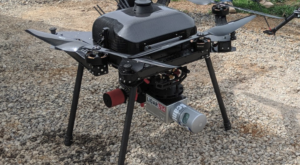
11:11 am
aerial drone, Carrier H4 Hybrid, Commercial Drones, Drone, drone LiDAR, Drone News Feeds, drone surveying, Featured - Surveying, Harris Aerial, hybrid drones, industrial drones, News, Sensors
Aerial LiDAR surveys aren’t new know-how – however now U.S. – based mostly Harris Aerial has demonstrated a new and ground-breaking manner of performing them. LiDAR surveys present critically correct survey information, permitting for the creation of exact 3D fashions. LiDAR hooked up to a helicopter or different manned plane …
Read More »
5:55 am
Business and Finance, DJI, Drone, drone surveying, Mining and Construction, News, Satumate, Surveying
Firms partner to provide software, app ease & automate surveying, infrastructure-mapping and inspection The Chinese drone powerhouse target=”_blank”> target=”_blank”> target=”_blank”> target=”_blank”> target=”_blank”> target=”_blank”>DJI and Datumate, a developer of geomatics software, are offering a drone, software and app package that automates and expedites site surveys. The DJI-Datumate Site Survey Solution is …
Read More »