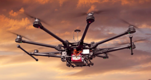
Since we’ve all had to stop traveling, virtual events are happening every single day in the commercial drone industry. These can be important events for companies and their customers – but it can be difficult to get your audience’s attention. DRONELIFE webinar support services can help. DRONELIFE and affiliates are now …
Read More »USC Spatial Sciences Institute Drones in GIS Mapping
The University of Southern California Spatial Sciences Institute offers flexible, online degree and certificate programs that provide the education -and the respected credentials – required to succeed in using drones for GIS mapping. Read on to learn more about how the University of Southern California is helping to shape the …
Read More »EHang stock soars: partnership rumors
News and Commentary. One of few publicly traded drone companies, EHang stock has risen significantly in the last month – and it’s reached the attention of the broader investment community, as even newsletter Motley Fool weighs in on why the stock has been doing so well. The rise in EHang stock …
Read More »Visualskies Finding Lost Cities with Drones
By DRONELIFE Staff Writer Jim Magill Using drones, 3D scanning technology, LIDAR and other state-of-the-art technology for measuring, interpreting and visualizing data, a UK-based company has done everything from uncovering lost civilizations to creating augmented reality for movies and television. Founded in 2014, Visualskies has grown from a company narrowly …
Read More »DroneTalks Academy: a Virtual Interactive Learning Platform
DroneTalks has launched a virtual, interactive learning platform to support the drone industry in Europe and around the world: DroneTalks Academy The drone industry is new, growing, and confusing to new comers. DroneTalks Academy organizers Eszter Kovacs and Lorenzo Murzilli are addressing the need to condense and clarify drone industry information …
Read More »Israeli Drone Delivery Pilot Demos GPS-Deprived Flight
The Israeli drone delivery pilot program has now demonstrated civil drone flights in GPS-denied environments, utilizing camera-based visual navigation. “The successful test will pave the way for autonomous drone delivery in Israel,” says a press release. The technology for autonomous drone flight is available: as is the technology for safe …
Read More »Airwards: Changing Hearts and Minds About Drones
By Dawn K. Zoldi, Guest Contributor As we all know, one of the toughest nuts to crack in helping the drone industry to “fly” is community acceptance. How can we change the hearts and minds of the public so that the average person views drones as being critically important …
Read More »Draganfly and Windfall Geotek Advance Testing of Drone-Based…
/EIN News/ — Los Angeles, CA., Feb. 11, 2021 (GLOBE NEWSWIRE) — Draganfly Inc. (OTCQB: DFLYF) (CSE: DFLY) (FSE: 3U8) (“Draganfly” or the “Company”), an award-winning, industry-leading drone solutions and systems developer, today announced that it has advanced field testing of the EagleEye™ land mine detection solution with Windfall Geotek …
Read More »Use satellite tech for farmers in crisis
A file photo shows parched land as farmers wait for rain. Government help for them often comes too little, too late. (Bangkok Post photo) Ask any Thai rice farmer to describe government assistance when they are hit with natural disasters. Their answers will most likely be the same: Too little, too …
Read More »Army sees counter-drone tools for cooks, medics — Defense S…
Unmanned Systems Army sees counter-drone tools for cooks, medics By Lauren C. Williams Feb 10, 2021 The Army is leading the Defense Department’s strategy for making platforms and devices to counter small unmanned aerial systems usable by all service members. In January, the Pentagon released its counter sUAS strategy, highlighting the …
Read More »