By DRONELIFE Staff Writer Jim Magill
Using drones, 3D scanning technology, LIDAR and other state-of-the-art technology for measuring, interpreting and visualizing data, a UK-based company has done everything from uncovering lost civilizations to creating augmented reality for movies and television.
Founded in 2014, Visualskies has grown from a company narrowly focused on capturing data from the air to a collaborative network of architects, archaeologists, surveyors and visual effects artists providing aerial- and ground-based filming and photography, high-definition 3D mapping and creating virtual- reality environments.
“We’ve developed an integrated system where we’re using terrestrial and aerial data-capture of all types — LIDAR, areal photogrammetry, heat-sensitive cameras, terrestrial laser scanners, terrestrial photogrammetry — and integrating those in the best way for our clients’ needs,” Duncan Lees, Visualskies 3D scanning specialist, said in an interview.
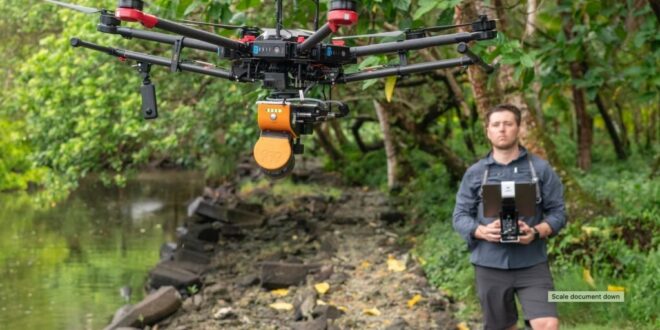
For its aerial photography, videography and other data-capture missions the company employs commercial drones, typically DJI M600 Pro and Inspire II Pro drones, which it equips with its own technology arrays.
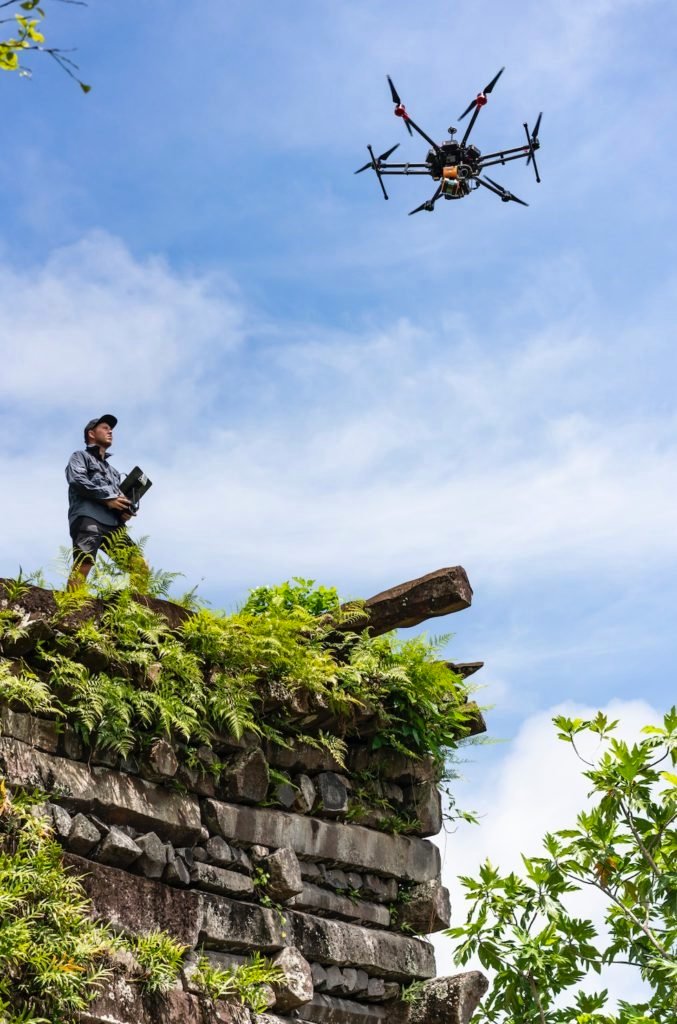
Among the most daunting challenges for Visualskies was taking part in the production of National Geographic’s TV series Lost Cities With Albert Lin, in which the company used its technology to reveal the remains of ancient civilizations in remote regions of the world, including the rugged rain forest in the coastal region of Northern Columbia and the dense jungles of Micronesia.
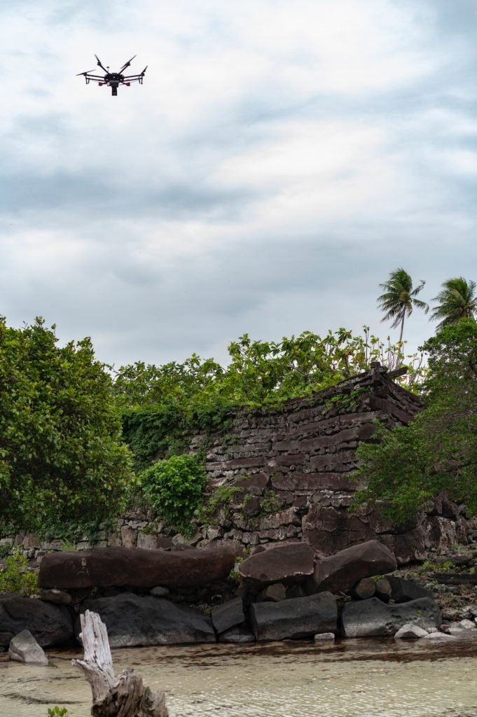 “We’re using technology that exists and adding bespoke developments,” Lees said. The Visualskies payload includes an array of multiple cameras on a specially engineered gimbal, which multiplies the amount of data that can be captured in a single flight. “Five cameras allow – instead of the normal photogrammatic process of capturing vertical and oblique shots – the collection of all of that information at once,” he said.
Mounting aerial LIDAR scanners on its drones gives the team “the ability to not just photograph from the air but also to use lasers to collect information,” Less said. “This is what has allowed us to penetrate the canopy in some of the heavily vegetated areas we were confronted with in the Lost Cities program.
Just getting to some of the sites of ancient, long-undiscovered ruins presented some special challenges for the team. “We were clambering up 4,000-meter mountains in Peru with heavy drone equipment and scanners and everything else,” Lees recalled.
In addition, given the tight time frame they were given for filming the series, the Visualskies team used its drone-mounted cameras and other data-capture equipment to record data while simultaneously shooting the visual images that would be shown in the series.
“The capture of information and the presenting of the information was all happening in the time scale as the programs were being filmed,” Lees said. “The reaction to the new discoveries we were making was real. It was true-to-life rather than a set-up several months later after a lot of processing had been done.”
As a result of the images and measurements taken from both the air and the ground, “people can get a sense of not only what the environment looks like now, but what it might look like with vegetation stripped away, and what it might have looked like 1,500 or 2,000 years ago when the archeological remains were being constructed,” Lees said.
Contributing to historic preservation
 Currently the Visualskies team is working in the northernmost region of Scotland on a Netflix series, which Lees said would further test the limits of the company’s image- and data-capturing technology. Filming for the series, the title of which has not been released, combines elements of both virtual reality with actual real-life backgrounds.
“There are large landscapes here that are going to be utilized in the filming in a virtual production sense — LED walls with digital backgrounds that allow [the filmmakers] to film real elements but with a CGI background in real time,” he said. “We’re creating huge digital landscapes using data capture from the air and on the ground to capture mountains and heathland and heather-covered landscapes, and snow and rock into a single integrated whole.”
The company’s next project will take it from creating a new reality to documenting history in the real world. Visualskies is waiting for the final approval from the British government to take part in a conservation and historical restoration project at the Palace of Westminster, the historic building that is home to the two Houses of Parliament and which serves as the seat of Britain’s democratic government.
“We will be flying drones inside and outside of the structure as well as taking laser-scanning and digital photogrammetry to provide a perfect digital representation of the structure,” Lees said.
“There’s a huge interest in making sure the fabric of the building is maintained in the best possible way. We’ll be contributing to that by providing a digital record of the building that is millimetric-perfect and would reveal any problems that exist.”
The Visualskies team will fly drones both outside and inside the structure, as well as employ laser scanning and digital photogrammetry to create a digital representation of the building. The project will involve both autonomous and pilot-controlled drone flights.
“After initially scouting the site and deciding on the parameters of the site, we used preprogrammed flights,” Lees said. “The array is set up so we fly programmed flights in two different directions, so we get a crossing of all of the data.”
However, some of the flights, particularly those inside of the building, will be pilot-controlled “because there’s simply no way of being as precise as you need to be unless you’re fully in control of the drones,” Lees said.
Although the data-capture work will only comprise three or four days, because the team cannot fly drones when Parliament is in session, the length of the project might be spread out over a month or even two months. In addition, because of the historic nature of the site as well as the ever-present threat of terrorism in Britain, the Visualskies team will have to receive the highest level of security in order to complete the project, Lees said.
“We even have to load our equipment into a separate security vehicle that then takes our equipment in; and we have to go through a separate security system and take nothing in ourselves,” he said.
Lees said the company’s level of technological experience as well as the broad scope of life experiences among members of the Visualskies team has helped open the door for the team to pursue a wide range of different projects.
“Sometimes we’re creating a reality that is entirely fabricated and other times we’re documenting something that exists, and it’s often difficult to separate the two,” he said.
Miriam McNabb is the Editor-in-Chief of DRONELIFE and CEO of JobForDrones, a professional drone services marketplace, and a fascinated observer of the emerging drone industry and the regulatory environment for drones. Miriam has penned over 3,000 articles focused on the commercial drone space and is an international speaker and recognized figure in the industry. Miriam has a degree from the University of Chicago and over 20 years of experience in high tech sales and marketing for new technologies.
For drone industry consulting or writing, Email Miriam.
TWITTER:@spaldingbarker
Subscribe to DroneLife here.
https://dronelife.com/2021/02/12/visualskies-meet-the-uk-studio-using-drones-to-find-lost-cities/
 Unmanned Aerial Vehicle The latest drone news
