4:35 am
Drone
The MarketWatch News Department was not involved in the creation of this content. Nov 11, 2020 (Market Insight Reports) — Selbyville, Delaware. A Research study on Agriculture Drones Market analyzes and offers ideas of exhaustive research on ancient and recent Agriculture Drones market size. Along with the estimated future possibilities …
Read More »
7:47 pm
correlator3d, Drone, drone mapping, Drone News Feeds, photogrammetry, SimActive
SimActive‘s new version of Correlator 3D, version 8.6, is feature-rich – making mapping from aerial images easier and more accurate all the time. Canada’s SimActive is a photogrammetry software that began as a solution for aerial images from satellite and manned aircraft. The inclusion of drone data in the solution …
Read More »
4:33 pm
Drone
Unmanned aerial vehicles are widely used in mapping, aerial photography, rescue operations, shipping, law enforcement, agriculture, among other things. In addition, drones hold considerable potential in relation to human exploration, enabling humans to take a closer look into areas that are far to dangerous for people to visit. Behind this …
Read More »
3:46 pm
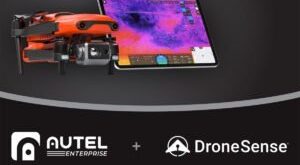
Autel Robotics, Drone, Drone News, Drone News Feeds, dronesense, Feature 1, Fire and Police, News, Public Safety Drones
Source: DroneSense Public-safety UAV software provider DroneSense is teaming up with drone manufacturer Autel Robotics to create a supercharged platform for public-safety operators using Autel’s EVO drone series. The partnership will marry the Autel EVO II Dual with DroneSense’s out-of-the-box solution for police, fire and rescue agencies designed to build, manage and …
Read More »
11:45 am
Drone, Drone News Feeds, ground images for photogrammetry, News, photogrammetry, Pix4D, Pix4dcatch
In a sign that the drone industry has reached a new phase in its evolution, drone companies are moving beyond drones. Photogrammetry solution provider Pix4D has launched Pix4Dcatch, a new app for getting ground images from iOS devices like iPads and iPhones. The new app means that operators can use …
Read More »
7:44 am
Ban on Chinese Drones, China, DJI, Drone, Drone News, Drone News Feeds, Japan, Legal, News
On the heels of recent U.S. government efforts to ban Chinese drones for official use, Japan this week announced a similar plan. According to a Reuters report, several government insiders say the initiative would shut out China from selling any drones to Japanese agencies in an effort “to protect sensitive …
Read More »
11:42 pm
Canada, Drone, Drone News, Drone News Feeds, News, SkySensus, Unifly, UTM
Source: SkySensus SkySensus, a Canadian drone research project, is flying high after it was selected to fulfill Canada’s official Remotely Piloted Aircraft Systems (RPAS) Traffic Management Service Trials. SkySensus will partner with Belgium-based Unifly, one of Europe’s big names in unmanned traffic management (UTM). Funded by national-security firm Peraton Canada, …
Read More »
10:30 pm
Drone
It’s a bird, it’s a plane, it’s…a drone. A tech company based on Salt Spring Island has become the first company in the country to receive a licence from the Canadian Transportation Agency (CTA) to carry commercial goods by drone. InDro Robotics Inc. has announced that it has been approved …
Read More »
7:41 pm
BEYOND program, Drone, Drone Delivery, drone delivery platforms, Drone News Feeds, News, U.S. IPP, Zing drone delivery
How do you scale drone deliveries? Zing drone delivery may have the answer, with a platform that allows licensed drone pilots from around the country to use their DJI drones, a Zing delivery kit, and an app to accept drone delivery jobs from consumers. Now, FL-based Zing announces that they …
Read More »
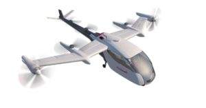
3:40 pm
Ballard Systems, Drone, Drone News Feeds, Honeywell, hydrogen fuel cells, Hydrogen fuel for drones, News, UAM
Fortune 100 companies are continuing investment in the drone industry. In further evidence of their interest in urban air mobility (UAM) and other advanced applications, Honeywell (NYSE: HON) purchased Ballard Unmanned Systems assets last month. Ballard Unmanned Systems is “a wholly owned subsidiary of Southborough, Mass.-based Ballard Power Systems Inc. …
Read More »