image courtesy SimActive
Philippe Simard, of Canada’s SimActive mapping software, started out working directly with large mapping companies – or the military. With the growth of the drone industry, however, things have changed. “We used to only work with very highly qualified firms investing millions of dollars in planes – I can still remember the point at which those clients came to us and said that they were considering drones,” says Simard. “We changed to accommodate, and we had to adapt everything. We did it gradually, starting in 2015: but now at least two thirds of the revenue is from drones. That’s fueling our growth.”
Now, SimActive is growing fast: they’ve increased staff by more than 50% in the last year to keep up with customer growth. “Drones have been a game changer for us,” says Simard. It’s a game that’s still changing. With new sensors, new drones, and new technology available, the industry keeps expanding – and software companies like SimActive are constantly evolving to stay abreast. “We’re constantly pushing R&D to stay ahead,” Simard says, “and we do that by constantly listening to the clients. They’re the ones telling us what they want to see, we’re reacting to market needs.”
Bigger and Better

image courtesy SimActive
Working with clients who may use both planes and drones for mapping depending upon the application, Simard says that his team has seen an interesting trend. “We are actually seeing a trend where our clients are buying more and more expensive drones and sensors,” Simard observes. “We’ve adjusted our software to accommodate new LiDAR that is super light, super small. They cost about $50,000 apiece: clients are starting to mount them on drones.”
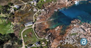
Mounting new and improved LiDAR on drones is a big step forward for enterprise applications. “LiDAR has an advantage over imagery – with imagery you can generate a point cloud, but the LiDAR can more easily penetrate vegetation,” explains Simard. “It allows the client to see the ground as well as the top of the trees.” This is an important capability for industries like forestry and mining.
SimActive has adapted their mapping software to optimize use of these new tools. “We allowed clients to combine photos with LidAR for each 3D point cloud we’ve collected, so that you can see color – visually that’s very helpful in analyzing the data.”
Evolving Industry Verticals
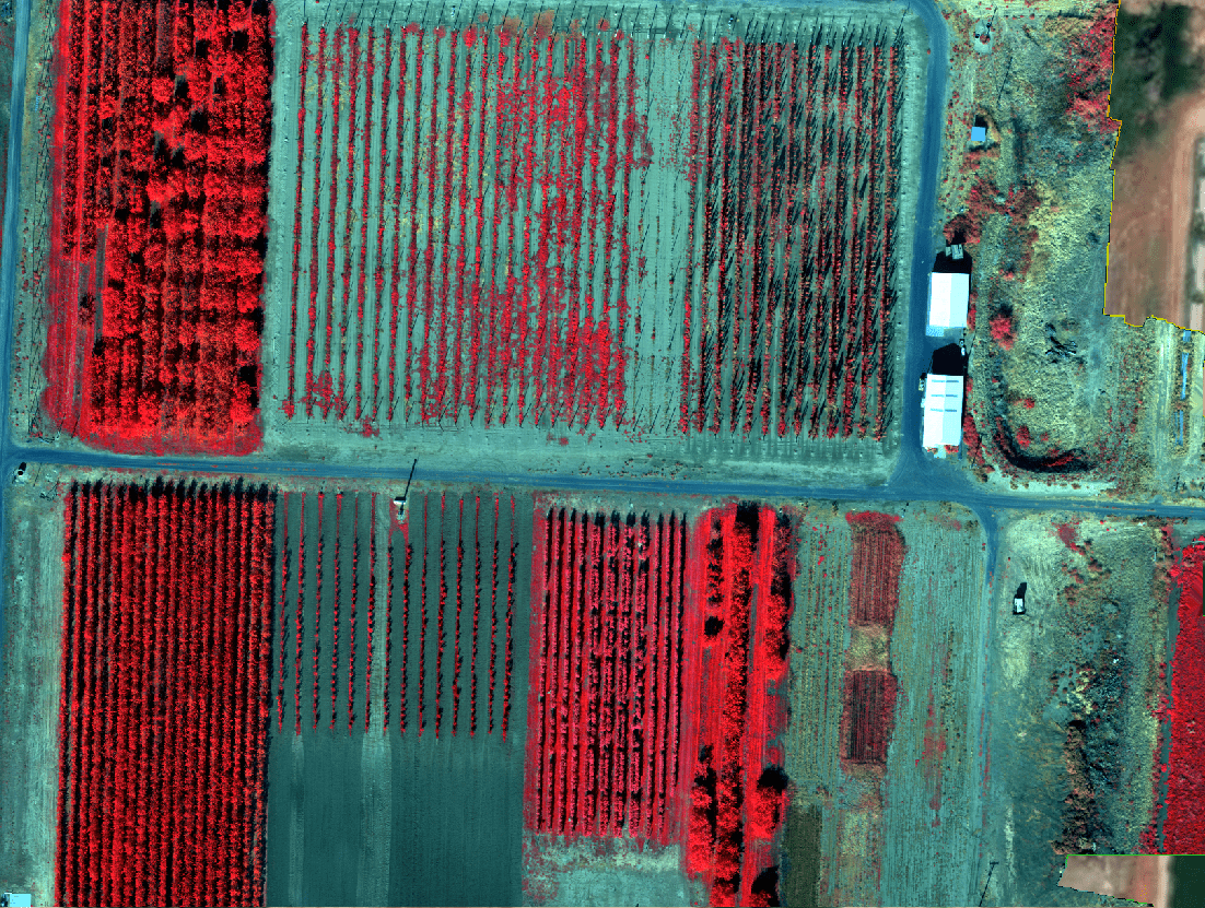
image courtesy SimActive
Better sensors have also meant that the drone industry’s target verticals have shifted. “For drones initially, all we were hearing about was agriculture,” says Simard. “There’s been a lot of development there with cheap multispectral sensors: those have significant value in agriculture.”
“We definitely see more and more of that – but the days when farmers are going to fly every day for every crop are not here yet. They have to be high value crops.”
SimActive sees two verticals as standing out for growth. “Mining has been a real growth area,” Simard says. “Mining companies are flying every week to do volume calculations about the material that has been taken out.”
“One application that we are hearing more and more about is construction. Construction firms want to fly the same place frequently to assess changes. That’s something that we see more and more – its’ a new technology for that industry, but they are quickly able to get up and running with a drone and with our software.”
What is SimActive doing now, during the current crisis? While they are working from home like everyone else, Simard says that they haven’t stopped. “We are open for business and supporting our clients,” says Simard.
Miriam McNabb is the Editor-in-Chief of DRONELIFE and CEO of JobForDrones, a professional drone services marketplace, and a fascinated observer of the emerging drone industry and the regulatory environment for drones. Miriam has a degree from the University of Chicago and over 20 years of experience in high tech sales and marketing for new technologies.
For drone industry consulting or writing, Email Miriam or (for paid consulting engagements only) request a meeting through AdvisoryCloud:

TWITTER:@spaldingbarker
Subscribe to DroneLife here.
https://dronelife.com/2020/04/03/drone-mapping-is-getting-bigger-and-better-simactives-philippe-simard-talks-industry-trends/


