Is drone mapping surveying without a license? A First Amendment lawsuit in North Carolina says surveyors cannot stop drone operators from selling photos and making maps.
Hiring a surveyor is an expensive buisness, but necessary if you want to establish legal property lines. What if you just want to see what your property looks like, or create a visual map of your property or work place in order to help make decisions about new development or see what type of topography you have? While previously, you may have had to hire surveyors to make a map, now that information is readily available by using aerial images. Commonly available commercial drone software is designed to do exactly this: creating orthomosaic maps and 3D images.
Surveyers apparently don’t like the competition. In North Carolina, they’re trying to push drone operators out of business. “…drone entrepreneurs on the cutting edge are finding a very old industry standing in the way: land surveying. In North Carolina, the Board of Examiners for Engineers and Surveyors [the NC Board] sends warnings to drone operators saying that certain photography amounts to surveying without a license and threatens them with possible criminal prosecution.”
If most commercial drone mapping – photos that include GPS information and/or measurements – amounts to “surveying without a license” then the NC Board is going to have their work cut out for them. That premise would require law enforcement teams using drone imagery to analyze accident scenes, Departments of Transportation using drone imagery for disaster response, and countless other commercial drone customers to get surveying licenses – which apparently is what the NC Board wants.
The Lawsuit
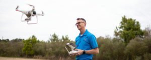
Michael Jones is photographer and videographer from North Carolina who expanded into drone imagery about five years ago. Jones takes aerial images for customers for a wide variety of purposes: real estate, property management and inspection, and marketing. When requested, Jones processes aerial images to create orthomosaics – as do thousands of drone operators around the country: drone mapping platform DroneDeploy alone has more than 5,000 customers, Pix4D, SimActive, and others have thousands more.
It was not until he received a warning letter from the Board in December 2018 that Michael had any idea that what he was doing could be considered “surveying.” He had always been careful to note that his work did not establish property lines and could not be used for legal purposes. But a Board investigator told him that providing images with any metadata (information about GPS coordinates, elevation, or distance) or that stitching together images qualified as surveying and required a full-blown, state-issued license. Worried about the Board’s threat that he could be fined or even criminally prosecuted, Michael shut down much of his drone business.
“When the surveying board wrote that I was breaking the law, I could hardly believe it,” said Jones. “I didn’t think that I was doing anything that could be considered surveying. In fact, I don’t know of any surveying company that was using drones like I was.”
It may seem unfair and unreasonable, but the intimidation works: most drone entrepreneurs can’t afford to take the chance of a lawsuit. Now, with the support of the Institute of Justice [IJ], Michael Jones is fighting back. “The images and maps that Michael was creating for willing customers were not being used to set legal boundaries; they were purely for informational purposes,” says an IJ press release. “And creating and sharing information is speech protected by the First Amendment. ” (Read the complaint here.)
“I really hope a successful lawsuit can prevent drone photographers all over the country from being targeted by their state surveying boards. There’s a lot of people doing innovative work, but that could come to a halt if a legacy industry stands in the way,” Jones tells DRONELIFE.
“Drone technology may be new, but the principles at stake in Michael’s case are as old as the nation itself,” said Sam Gedge, an attorney with the Institute for Justice. “Taking photos and providing information to willing clients isn’t ‘surveying’; it’s speech, and it’s protected by the First Amendment.”
“This is just the newest example of a licensing board expanding its authority to crack down on competition,” said IJ Attorney James Knight. “But licensing boards should not be able to use their authority just to protect businesses from competition. The government should step out of the way and let innovative businesses like Michael’s continue serving their customers.”
Drone mapping isn’t surveying for the vast majority of cases – but it could be. Instead of trying to shut him down, surveyors should be hiring Michael to train them. Drones can be a fantastic tool for surveyors, saving them time, money and physical work. Surveyors won’t be able to beat ’em, they should be moving as fast as possible to join ’em.
Miriam McNabb is the Editor-in-Chief of DRONELIFE and CEO of JobForDrones, a professional drone services marketplace, and a fascinated observer of the emerging drone industry and the regulatory environment for drones. Miriam has penned over 3,000 articles focused on the commercial drone space and is an international speaker and recognized figure in the industry. Miriam has a degree from the University of Chicago and over 20 years of experience in high tech sales and marketing for new technologies.
For drone industry consulting or writing, Email Miriam.
TWITTER:@spaldingbarker
Subscribe to DroneLife here.
https://dronelife.com/2021/03/23/surveyors-wanted-to-shut-this-drone-photographer-down-for-providing-aerial-photographs-now-hes-fighting-back/
 Unmanned Aerial Vehicle The latest drone news


