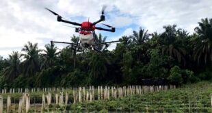
MILL CREEK – Washington Department of Fish and Wildlife (WDFW) staff will fly drones over known locations of swan and goose flocks in Skagit, Snohomish, and Whatcom counties to assess the technology’s utility in surveying abundant waterfowl. Flights may take place from December 2023 through May 2024. WDFW staff with Federal Aviation Administration …
Read More »LDA decides to use drone technology for surveys – Pakistan
LAHORE: The Lahore Development Authority (LDA) was pondering over the usage of drone technology for surveys and subsequent follow-ups in its controlled areas. This was disclosed during a meeting chaired by LDA DG Muhammad Ali Randhawa on Friday. The meeting was attended by Additional Commissioner Abdul Salam Arif, Additional DG …
Read More »Maharashtra Gets 25 Drones to Conduct Faster Land Surveys in…
According to officials, drones with high-resolution fitting cameras will be used to map land parcels in the villages and to establish the positions of village boundaries, canals, and roads in these villages. The Centre purchased around 200 drones to map the country’s 6.62 …
Read More » Unmanned Aerial Vehicle The latest drone news

