It’s innovative, but will companies embed it for their mission control?
QuickTake
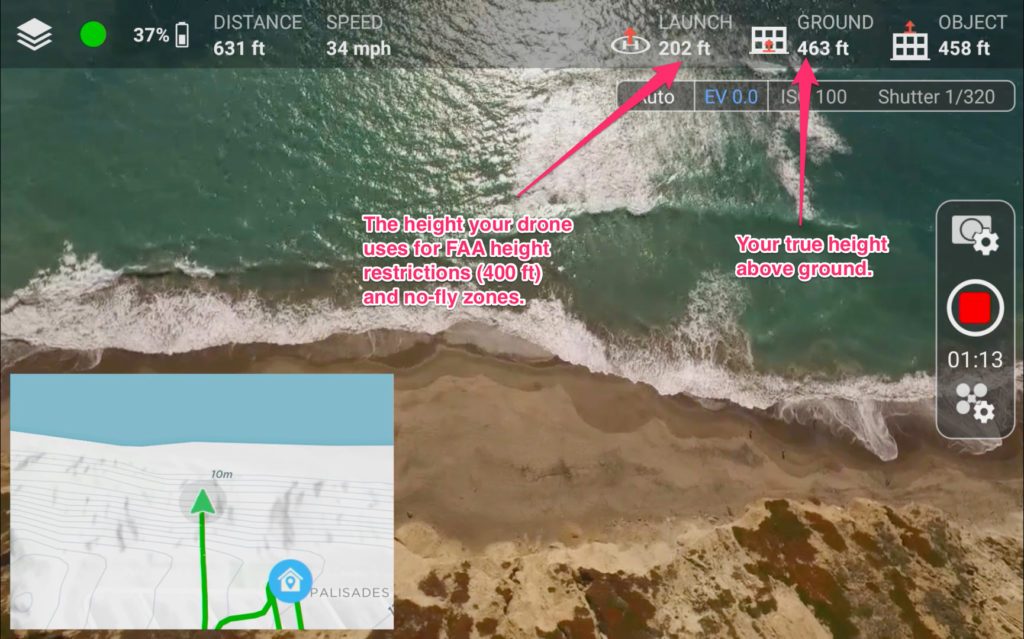
THE FACTS: Last week Hivemapper introduced its 3D earth maps Android app for drones. The preview I received a week earlier was impressive. Hivemapper is a mapping and navigation tool for drone operators to fly more safely and plan missions with awareness of the exact height and 3D footprint of buildings, trees, poles and other structures. Features include:
- intelligent altitude (drone’s true height above bare earth),
- an in-flight 3D map with collision avoidance alerts that provides distance to 3D objects,
- and the ability to do quick object surveys.
The product has been in development since 2015 and was built using the DJI SDK – so it currently works only for DJI Phantoms and Inspire 1 drones.

WHAT’S COOL: Product features go way beyond what you find in Google Maps, Google Earth, and intelligent no-fly zone map programs like Airmap or Mapbox. Two things make Hivemapper innovative:
- The object point cloud information already contained in their maps—like building, trees, and power line locations and dimensions—boasts centimeter-level accuracy from 6 trillion points with 100% of the US coverage for Intelligent altitude and 60% for 3D objects with more to come.
- The second innovation is the ability to collect and add new data from users with an in-app object survey tool. The tool works like a count-down game. As drones circle an object, slices of a pie disappear until none are left. This means the data is complete and can be sent back to crowdsource-update the centralized map for future use.
Other drone app and software developers should make note that Hivemapper has tapped into two very important development techniques: crowdsourcing and gamification. Original data has been captured by existing users’ drones, but ongoing the game design element fosters engagement that supports further data capture.
THE COMPETITION: To be clear, Hivemapper is not alone in their quest to “build a better mouse trap” map for drones. Angel funded Point One Navigation is on a quest to provide a similar ultra-precise location service. But the big question is whether drone mission planning and ground control vendors like 3DR, DroneDeploy, PrecisionHawk, senseFly, UgCS, and even DJI GEO will embed Hivemapper. I believe the use case is compelling. If you don’t understand where a drone is located in all three dimensions then having no-fly zones and 400 foot maximum height limits is pointless in many parts of the U.S. Hivemapper provides those features plus ones the others don’t have—like route planning around objects of unknown height and dimension, route validation, and a much better return home safety route than is provided by simple onboard object avoidance technology.
BOTTOM LINE: Watch this space—the market for maps and apps that give operators awareness of what they could collide – which is heating up. And Hivemapper has a leg up because of their unique and compelling approach with its crowdsourced gamification.
 Colin Snow is CEO and Founder of Skylogic Research, LLC (aka Drone Analyst®), a research, content, and advisory services firm for the commercial drone industry. Colin is a 25-year technology industry veteran with a background in market research, enterprise software, electronics, digital imaging, and mobility.
Source link
 Unmanned Aerial Vehicle The latest drone news


