Source: DJI
Drone giant DJI today launched a new mapping solution to optimize rescue drones.
Drone Rescue Map is an online reference that globally tracks events involving life-saving drones.
The map has already depicted rescue drones helping more than 400 people in more than 200 emergency situations.
“Each entry on the map includes the location and date of the incident, a brief description, a link to the original story or post and an easy way to share those incidents online,” a DJI spokesperson explained. “To make the map as definitive as possible, DJI encourages public-safety agencies to share additional drone rescues so they can be included.”
“The DJI Drone Rescue Map is now the best global reference for how effective drones are in emergencies and allows the world to see the tremendous impact drones have had in finding lost people, shortening searches, reducing risks to rescuers and saving lives,” DJI Senior Director of Public Safety Integration Romeo Durscher said in a press release.
“Public safety workers already know how drones are revolutionizing their work, and now the rest of the world can see their amazing stories in one place. The DJI Drone Rescue Map honors the incredible rescues they’ve made and will allow everyone to see how drones help save people in the future.”
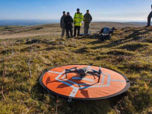
The map includes instances of drones finding people lost in forests, fields and mountains. Often, UAVs find missing persons at night, thanks to thermal imagery. Drones can also drop life preservers to potential drowning victims.
The map excludes events in which a rescue drone is only used as part of a larger effort. “A drone must have directly located, assisted or rescued a person in peril,” Durscher added.
Anyone who knows of a drone-involved rescue not included on the map can submit it through a form at the bottom of the map page.
“Drones have changed the game for finding and saving people lost in difficult conditions, and twice last year drones made the difference for us in finding and saving stranded hikers in dangerous terrain at night,” said Kyle Nordfors, drone team coordinator for Weber County (Utah) Search and Rescue.
According to DJI, reported instances of drones saving lives happen weekly.
“Hundreds of examples now make clear that making drones widely accessible, with low barriers to entry and subject to a progressive set of operational regulations, leads inevitably to saving more lives around the world,” said Brendan Schulman, DJI Vice President of Policy & Legal Affairs.
Schulman added that the Drone Rescue Map provides “a powerful resource for policymakers to understand the impact drones have on protecting vulnerable people in their own communities.”
Jason is a longstanding contributor to DroneLife with an avid interest in all things tech. He focuses on anti-drone technologies and the public safety sector; police, fire, and search and rescue.
Beginning his career as a journalist in 1996, Jason has since written and edited thousands of engaging news articles, blog posts, press releases and online content.
Email Jason
TWITTER:@JasonPReagan
Subscribe to DroneLife here.
https://dronelife.com/2020/06/29/dji-drone-rescue-map/


