
Image DroneDeploy
Drone manufacturer DJI and leading commercial drone cloud software platform DroneDeploy announced a new thermal mapping solution yesterday at the Intersolar North America conference. The announcement was well-placed: a drone thermal mapping solution could dramatically increase the efficiency – and lower the cost – of the solar panel installation and inspection. In fact, the potential savings for thermal image processing by drone in construction and inspection could be a game changer for the drone industry in those verticals.
Using DroneDeploy thermal image processing, solar panel installers could be able to make the required measurements on residential rooftops in half the time the process currently takes – and a commercial installation which may take days using current methods could take only minutes using a drone. It’s another example of drones making the process not only faster, but better: DroneDeploy’s thermal image processing can help place solar equipment more precisely for maximum production.
DJI announced a partnership with Flir last December to bring thermal cameras to the air. The resulting collaboration – the Zenmuse XT thermal camera – is now available for the DJI Inspire, making the thermal image technology wid
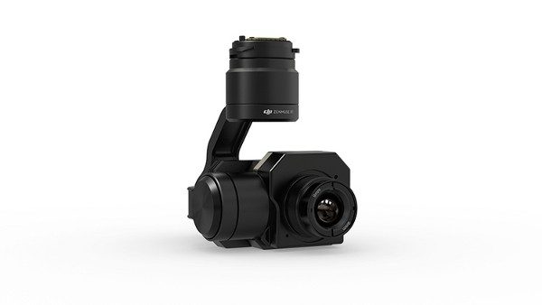
Zenmuse XT
ely obtainable to drone operators. The Zenmuse XT combines DJI’s Zenmuse stabilized micro-gimbal technology with FLIR’s Tau 2 thermal imaging camera core. The thermal imaging allows operators to see in darkness, measure temperature remotely – even tiny temperature variations – and to see through things like dust, smoke, or fog.
DroneDeploy has worked closely with DJI to take the technology a step further, making thermal mapping and data processing easily accessible to commercial drone operators. While solar panel installation and other construction applications are an obvious use for thermal mapping technology, there are many; the thermal image processing can help to monitor electrical infrastructure for safety, or livestock for health, for example.
DroneDeploy’s new thermal image processing solution is currently in beta test – to get more information, email [email protected].
Source link


