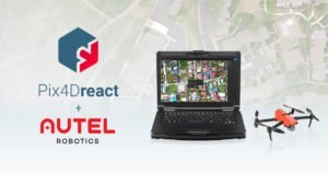
Last year at Commercial UAV Expo in Las Vegas, DRONELIFE got to see two amazing products at work. Demonstrated by the Las Vegas Police Department and Sundance Media Group, the Autel Evo II flew over a mock nighttime crime scene for evidence documentation: and Pix4Dreact, Pix4D’s real-time mapping solution for law enforcement, sent the scene to a large screen on a command vehicle nearby so observers could get immediate and exact situational awareness. Now, Autel and Pix4D are partnering to provide public safety teams with that same powerful product combination. 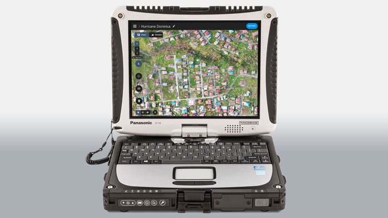
We’ve written before about Pix4Dreact. It’s a product notable for it’s purpose-driven design: made for law enforcement officers in the field, developed to work on the equipment that law enforcement officers already have, to provide a fast and effective drone mapping solution with the least complicated and easiest to use interface possible. Pix4Dreact creates an accurate 2D map to provide situational awareness – quickly, simply, effectively. Now, Pix4Dreact is compatible with all Autel Evo II camera models for real color mapping.
Autel’s Evo II is an aircraft also made for hard work in a wide variety of conditions. It’s easy to use, lightweight but sturdy, and affordable. This new partnership is not only compelling from a pricing perspective, but from a time perspective. Drones require a way to deliver their data to the right people. Law enforcement agencies can take advantae of the partnership and move quickly to put an effective solution in the air, without a long learning curve.
These new bundles include the Autel Evo II drone (available with 8k, 6k, or Dual camera options), a hard carrying case, one additional flight battery and a yearly license of Pix4Dreact. This collaborative effort between Autel Robotics and Pix4D combines one of the fastest “out of the box, into the air” drones on the market with Pix4D’s fast-mapping software for emergency response.

“We are very proud to partner with Autel Robotics to bring this simple-to-use yet powerful drone-mapping solution to first responders”, says Christopher Cressy, Managing Director for Pix4D North America. “The Evo II is an impressive drone platform and ideally suited to public safety missions. It’s light, fast, and easy to operate. Paired with Pix4Dreact and a simple laptop computer, any drone pilot or responder on the ground can generate and share a high-resolution scale map in minutes, anywhere in the world, with or without network connectivity.” Gary DeLuca, Autel Robotics USA’s CEO, adds “At Autel Robotics, we are proud to offer the fastest rapid-deployment aircraft in the industry, and the speed of Pix4Dreact is the ideal complementary application for our aircraft. No other application, and no other aerial product in public safety and construction industries output actionable data as efficiently, accurately, and with quality orthomosaics as Pix4Dreact partnered with Autel Enterprise.”
The Autel Evo II Rugged bundles, including Pix4Dreact are immediately available for USD 2095.00 (EVO II Pro) or $9998.00 (EVO II Dual). These prices could change after publication date (August 2020): please check with manufacturers or resellers for up-to-date information.
Miriam McNabb is the Editor-in-Chief of DRONELIFE and CEO of JobForDrones, a professional drone services marketplace, and a fascinated observer of the emerging drone industry and the regulatory environment for drones. Miriam has penned over 3,000 articles focused on the commercial drone space and is an international speaker and recognized figure in the industry. Miriam has a degree from the University of Chicago and over 20 years of experience in high tech sales and marketing for new technologies.
For drone industry consulting or writing, Email Miriam.
TWITTER:@spaldingbarker
Subscribe to DroneLife here.
https://dronelife.com/2020/08/27/autel-and-pix4d-partner-for-the-ultimate-public-safety-drone-solution/


