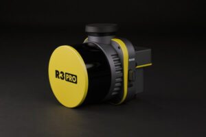
ROCK Robotic Launches R3 and R3 PRO LiDAR Mapping Systems
by DRONELIFE Staff Writer Ian M. Crosby
ROCK Robotic, a developer of professional survey-grade LiDAR technology, has announced the launch of the R3 and R3 PRO systems, its latest in LiDAR mapping solutions. The R3 product line incorporates advanced hardware components within a lightweight, integrated 3D point cloud collection tool. The R3 is an intuitive, end-to-end LiDAR solution that will integrate into ROCK Robotic’s comprehensive LiDAR approach.
“The ROCK R3 PRO is a major step forward for ROCK Robotic,” said ROCK Robotic CEO Harrison Knoll. “It offers better accuracy, better SLAM, a better camera, a lighter payload — basically a better product all around. Not only will our current customers love it, but we’re confident that the R3 will attract new customers who want a great hardware product along with our great software and support.”
The ROCK R3 line features state-of-the-art technology such as a geodetic-grade GNSS receiver and tactical-grade IMU. The device comes equipped with a detachable 26MP camera for high-resolution RGB image capture. The R3 employs a Hesai Pandar XT16 sensor, while the R3 PRO offers the superior Hesai Pandar XT32 sensor. The solution weighs only 1.26 kg (2.77 lb) compared to its predecessor, the ROCK 360 system’s 1.70 kg (3.74 lb). The R3 also provides optional advanced SLAM capabilities for mapping on the ground and in areas with weak GNSS signals.
“We want surveyors and mapping professionals to have the simplest workflow while getting the best results and deliverables,” said Knoll. “From the time you’re out in the field flying your drone to when you send deliverables to your client, ROCK makes it as easy as possible to make it happen. With the recently released ROCK Desktop software, R3 system and ROCK Cloud post-processing software, we’ve got all the bases covered. ROCK is definitely stepping up as a major player in the LiDAR arena.”
Read more:
Ian attended Dominican University of California, where he received a BA in English in 2019. With a lifelong passion for writing and storytelling and a keen interest in technology, he is now contributing to DroneLife as a staff writer.
Miriam McNabb is the Editor-in-Chief of DRONELIFE and CEO of JobForDrones, a professional drone services marketplace, and a fascinated observer of the emerging drone industry and the regulatory environment for drones. Miriam has penned over 3,000 articles focused on the commercial drone space and is an international speaker and recognized figure in the industry. Miriam has a degree from the University of Chicago and over 20 years of experience in high tech sales and marketing for new technologies.
For drone industry consulting or writing, Email Miriam.
TWITTER:@spaldingbarker
Subscribe to DroneLife here.
https://dronelife.com/2023/04/21/rock-robotic-releases-new-lidar-systems-for-advanced-survey-grade-mapping/
 Unmanned Aerial Vehicle The latest drone news


