On-Time Package Delivery
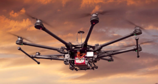
Society is becoming much more aware of the enormous potential uses for UAS to perform multiple tasks that would streamline and reduce costs in many of the routine tasks of industrial applications. One of these uses, which has great relevance, is on-demand delivery or medical transportation.
According to McKinsey, over the past three years, there has been more than 660,000 commercial drone deliveries to customers, not including the countless test flights to develop and prove the technology (Exhibit). In the same way, as we previously mentioned in our whitepaper on Package Drone Delivery, Deloitte estimates a value of US$115B in 2035 for package delivery using drones, with a market growth rate of 48% by 2029.
The extensive use of unmanned aircraft for these purposes would increase the low altitude air traffic and the probability of accidents. Relying on a technology that guarantees the precise and on-time reception of cargo and eases correct air traffic management by ATC (Air Traffic Control) becomes a critical need to make these applications a reality.
Another example would be a UAV taking off from an airfield which is at a significant distance from the mission area. If the UAV requires a segregated airspace, it is critical to overfly certain areas following a given schedule allowing for airspace optimization. Using 4D trajectories assures the fulfilment of this schedule.
Multi-UAV Coordination Flight
Multi-UAV operations are complex unmanned operations where more than one unmanned aircraft is commanded from a single ground control station. This advanced type of mission requires an advanced flight control system capable of managing the complex schema of operation with multiple telemetry links and commands.
Multi-UAV flights are very useful for military purposes. However, controlling two UAVs in flight is very stressful for remote operators who must coordinate their movements to perform their missions. One of these missions is aerial target emulation in military training exercises. For example, the testing of radar systems against multiple platform attacks.
Some of these missions would require the use of two or more UAT (Unmanned Aerial Targets) simulating a coordinated penetration attack over a coastline. During this test for operatives, all target drones will perform a flight where time is a critical variable to create a demanding scenario where the radar systems under test should squeeze all their capabilities.
To give a professional solution to these and other drone applications where time is a critical variable, UAV Navigation-Grupo Oesía has developed the 4D Trajectory capability. This new system capability enables the operator to configure the time at which a specific waypoint will be reached. The autopilot will adjust the aircraft’s airspeed to arrive at these assigned waypoints along its route at the specified time.
UAV Navigation-Grupo Oesía advanced ground control software, Visionair, includes an intuitive configuration tool that will make the on-time flight configuration an easy and user-friendly interface to track the flight and monitor the UAS performance with the ETA (Estimated Time of Arrival) display on the main display of the software.
The company continues providing cutting-edge functionality to enable its FCC customers to perform the unmanned aviation missions of the future.