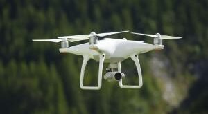
WARREN COUNTY | Aerial surveillance of ice buildup on the Hudson River is now being conducted in Warren County to detect the formation of ice jams.
County Emergency Services Director Brian LaFlure told county supervisors at their January meeting that his office has been using drones to record videos of ice formation on the Hudson River between Stony Creek Ranch Resort northward to The Glen bridge.
A few days later, a flood warning was issued Jan. 22 due to an ice jam that was detected building up at the Route 8 bridge at Riparius, backing up water behind it.
The ice jam and minor flooding was caused by several days of heavy rain and unseasonally warm temperatures thawing the river and sending huge chunks of ice downstream. Ice buildup was detected along about six miles of the Hudson River, LaFlure reported. The following day, however, the warning was canceled as the ice moved past the bridge.
Last winter, ice jams at the Thurman-Warrensburg bridge caused considerable damage to River Road and Route 418, closing the bridge for about two weeks.
For about a month during January and February last winter, these ice jams on the Hudson stretched over a mile long, as thousands of tons of ice were piled up to six feet high in places.
In the early 1980s and 1990s, Warren County experienced several serious ice jams that prompted evacuations, road washouts, and major damage to properties along the Hudson River.
At the Jan. 18 Warren Board of Supervisors meeting, LaFlure said that the surveillance by drones is helpful in minimizing such damage and protecting public safety.
“We’re trying to stay on top of it all,” he said.
He said that early-season surveillance by drones allowed public safety personnel to determine the route of the river channel before it is obscured by snow.
At that meeting, county Administrator Ryan Moore warned that the National Weather Service was operating with merely a “skeleton crew” which might hamper the agency is reporting timely river-level data.
LaFlure said last week that the county was now using a high-technology drone owned by the state Department of Environmental Conservation, but it was anticipating an arrangement with Washington County’s Office of Emergency Services and their Sheriff’s Office to use their drones. Together, these two Washington County agencies own and operate six drones.
He said Warren County was likely to have several people obtain certification as drone pilots, and he personally was working towards achieving such status.
LaFlure said the county was considering obtaining a drone — equipped with infrared thermal detection for uses other than monitoring ice jams, like locating people lost in the woods, detecting fires, and finding fugitives hiding from law enforcement.
“It’s amazing what drones can do,” he said.
 Unmanned Aerial Vehicle The latest drone news


