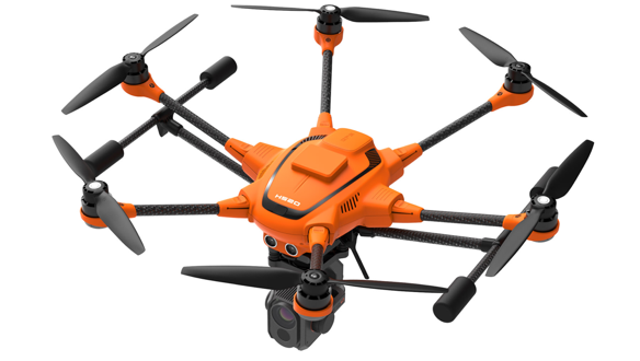
Drone manufacturer Yuneec has announced that its commercial hexacopter, the H520, will now be optionally available with an RTK (Real Time Kinematic) system. The addition of the RTK system from Swiss company Fixposition, means that even under difficult GPS conditions – in dense urban areas or canyons, for example – pilots and aerial data gatherers can benefit from centimeter-precise positioning.
Yuneec is targeting commercial applications in which accurate recurring images, faster 3D mapping and automated inspection flights need to be as precise as possible.
Read more: One InterDrone Announcement Stands Out from the Crowd: 3DR, Yuneec and Dronecode
What is RTK?
Real Time Kinematic is a technique that improves the accuracy of GPS signals. Usually this is done with the help of a fixed base station wirelessly broadcasting corrections to a moving receiver. In the case of the H520, there will be an RTK module on board of the H520 that receives information from a base station.
Yuneec say that the new receiver and base station combination allows the H520 to reach centimeter-level precision in under 30 seconds.
In case pilots don’t want to use a base station, the new system from Yuneec can also be operated with a network RTK reference station (Network RTK through third party provider. This requires an internet connection and additional fees will most probably apply.
So what does this mean in practical terms for drone operations? Well, many commercial missions require precision, whether pilots are mapping small areas or setting up autonomous inspections. By using RTK technology, the H520 can now fly much closer to objects for inspection.
You can imagine how important this degree of accuracy is in cases where multiple images need to be recorded from the same exact location on different days. No doubt pilots documenting progress on construction sites or mines will appreciate the improved precision.
The new navigation system also it possible to reduce image overlaps. In practice that means fewer photos and shorter model calculation times, speeding up workflows, not just data gathering.
Yuneec’s H520 RTK
The H520 RTK works with two components: the RTK module on board the H520 and a base station on the ground. For precise navigation, the module supports constellations of up to three different satellite systems from GPS, GLONASS, Galileo and BeiDou.
The H520 RTK will be available in the second quarter of 2019 in different configurations: as a complete system including the H520 airframe and RTK module, for $3199, and as an upgrade for existing H520 customers for $1699. The H520 RTK GPS ground station will be sold separately for $2399.
The complete specs and technical details of the Yuneec H520 with RTK system can be found here.
Malek Murison is a freelance writer and editor with a passion for tech trends and innovation. He handles product reviews, major releases and keeps an eye on the enthusiast market for DroneLife.
Email Malek
Twitter:@malekmurison
Subscribe to DroneLife here.
https://dronelife.com/2019/02/01/yuneec-rtk-satellite-navigation-h520-drone/
 Unmanned Aerial Vehicle The latest drone news


