DroneDeploy‘s annual user conference opened today in San Francisco; and in addition to training opportunities, partner demonstrations, and a lot of face time with other drone professionals;, the company is offering a closer look at the technology behind their industry-leading platform.
DroneDeploy co-founder Jono Millin said in his opening remarks that working in the drone space offers a unique opportunity. When speaking with users, says Millin: “I get to watch an entire industry being formed in front of my eyes.”
To help those users understand DroneDeploy’s focus and get the best out of their platform, Nicholas Pilkington, co-founder and CTO, kicked off the day with an introduction to photogrammetry and MapEngine, explaining how the process works to create high quality mapping and measurements.
MapEngine’s focus is three-fold. The platform is “Cloud-charged – so that we can always take advantage of the latest and greatest hardware,” explains Pilkington. “It’s industry-tuned: we’re focused on drone imagery in the industries our customers care about most. And it’s in your pocket. Much of our technology is being developed for mobile.”
Pilkington then went on to explain how MapEngine takes aerial images and creates high quality output. “Photogrammetry means measuring using light,” says Pilkington. “And it starts with the camera. Distortion , even slight, is an issue when you are measuring things…scale is also an issue, it’s difficult to see how big things are from a photograph.”
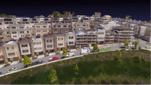
“We’re creating a 3D reconstruction,” says Pilkington. “We’re not just stitching images together out on the ground – that’s not a true orthomosaic or map. You need perspective, true reconstructions looked at from the top down. ”
MapEngine is a sophisticated piece of software that takes images and applies a series of processes to reach the end product:
- Calibration – the software matches points in multiple images, determines the internal geometry of the camera and establishes where the images were taken.
- Densify – the software uses neighboring views to estimate the depth of pixels in an image. Then MapEngine fuses depth maps into a dense point cloud.
- Meshing – MapEngine fits a surface through the dense point cloud to mitigate holes, noise, outliers, and misalignment.
- Texturing – the software generates 3D model texture using views perpendicular to each surface to color in the point cloud.
Finally, the software generates an orthomosaic using nadir views, looking straight down at the 3D model from the top to create the map.
It’s a simplified explanation of the complex process that the software performs, but it helps users understand what the software is looking for in order to provide better data to get a better output. If those steps weren’t obvious, that’s because DroneDeploy has worked to make the process seamless for the user. “We make a huge investment in making this as fast as possible and as useful as possible,” says Pilkington.
In addition to Pilkington’s MapEngine discussion, today’s conference content was in-depth and focused on professionals. “The vast majority of the people in this room are actually using drones to provide value,” explains Millin. “That makes this a special conference.”
Miriam McNabb is the Editor-in-Chief of DRONELIFE and CEO of JobForDrones, a professional drone services marketplace, and a fascinated observer of the emerging drone industry and the regulatory environment for drones. Miriam has a degree from the University of Chicago and over 20 years of experience in high tech sales and marketing for new technologies.
Email Miriam
TWITTER:@spaldingbarker
Subscribe to DroneLife here.
https://dronelife.com/2018/10/11/dronedeploy-gives-a-peak-under-the-hood-of-mapengine/
 Unmanned Aerial Vehicle The latest drone news

