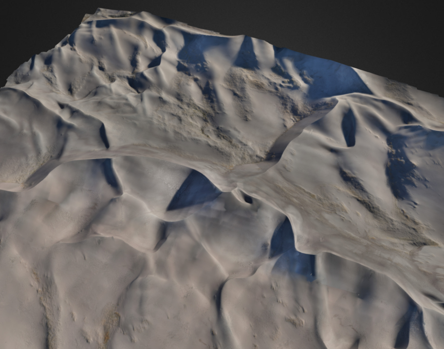
A rendering of the three dimensional data set obtained from the Great Sand Dunes mapping project.
UAS Colorado, a non-profit business league committed to promoting and improving the commercial drone industry in Colorado, has announced that the first drone mapping project within a US National Park has been completed at the Great Sand Dunes National Park and Preserve. The project offered stunning images of the park and critical data for the Park Service.
The project was a collaborative effort between UAS Colorado, the National Park Service (NPS), Wohnrade Civil Engineers, and Colorado-based drone company Blackswift Technologies.
The project was designed to remap the designated area to compare to a 2011 airborne LiDAR acquisition prepared by the United States Geological Survey (USGS). The comparison was necessary in order to monitor change in the terrain. Technologists used high-fidelity remote sensing to monitor change such as the erosion of the dunes, measure dune height in the vicinity of the Star Dune, and to visualize and document the Park’s assets.
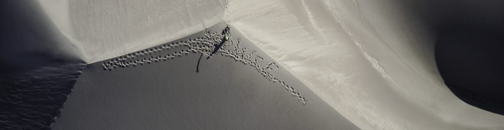
Star Dune. Photo courtesy Black Swift Technology.
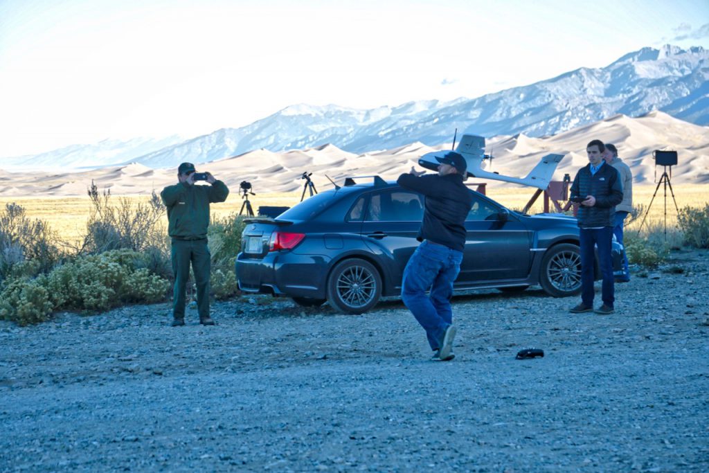
Photo courtesy Constantin Diehl
The mission – over extremely challenging terrain – was flown by Black Swift’s founder and CEO, Jack Elston, PhD. Black Swift’s SwiftTrainer fixed-wing drone demonstrated exceptional flight endurance and accuracy during the project. “Black Swift Technologies was excited to be a part of this landmark effort, and were excited to face the challenges of the project with our industry leading SwiftTrainer aircraft,” Elston tells DRONELIFE. “This required operations at altitudes of up to 9000′ altitude MSL and gathering data over an area of interest more than 5 miles from the launch and recovery site, something that exceeds the operational limits of most small drones. It was great working with UAS Colorado and Wohnrade Civil Engineers to continue to use our products and skill set to provide a robust mapping solution for commercial needs.”
The project makes Wohnrade Civil Engineers the very first FAA-licensed service provider to use a drone to successfully map a one (1) square mile area of the Great Sand Dunes National Park & Preserve, demonstrating an improved method of data collection critical for environmental preservation.


