6:39 pm
Drone, drone mapping, News, philippe simard, SimActive, Sponsored Content
The following is a guest post by Philippe Simard, Ph.D., President of SimActive, Inc. Global Trends in the Mapping Industry during the Pandemic The pandemic has brough uncertainties to all businesses and the mapping industry has been no exception. Slowdowns were observed during the first few months of 2020 as …
Read More »
8:07 pm
Agriculture, Applications, Drone, drone mapping, drone mapping platform, Drone News Feeds, DroneDeploy, News
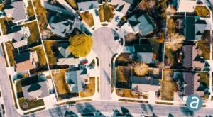
DroneDeploy‘s new release shows that despite the coronavirus, the company is working to ensure that businesses can get the data they need – regardless of the circumstances. DroneDeploy has expanded their product offering continually over the last several years. The spring release may be one of the biggest yet: with …
Read More »
6:15 pm
DL Exclusive, Drone, drone mapping, Drone News Feeds, drones for forestry, drones in agriculture, drones in mining, Feature 1, LiDAR for drones, multispectral imaging, News, philippe simard, SimActive
image courtesy SimActive Philippe Simard, of Canada’s SimActive mapping software, started out working directly with large mapping companies – or the military. With the growth of the drone industry, however, things have changed. “We used to only work with very highly qualified firms investing millions of dollars in planes – …
Read More »
6:06 am
Commercial Drone Mapping, Drone, drone mapping, drone mapping platform, Drone News Feeds, hivemapper, March Mapness, News
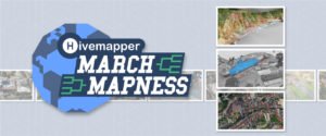
Drone pilots are quarantined like everyone else – but if you can get out of the house to log some flying hours, you won’t want to miss Hivemapper’s March Mapness contest. The contest is open to all drone pilots flying almost any hardware or camera, and you can create a …
Read More »
6:24 pm
Drone, drone mapping, Drone News Feeds, DroneDeploy, drones and wine, drones in agriculture, Feature 1, Featured - Agriculture, News, Precision Agriculture
License: cc0 With a wide and global customer base, drone mapping platform DroneDeploy is continually identifying new uses for drone technology. Precision agriculture was one of the early adopters of drone technology: and now, more vineyards are adopting drones to make better wine. It’s not the romantic view of the …
Read More »
1:01 pm
correlator3d, Drone, drone mapping, Products, SimActive, Sponsored Content
SimActive Further Accelerates Processing with New Version 8.4 Montreal, Canada, January 14th, 2020 – SimActive Inc., a world-leading developer of photogrammetry software, announces the release of Correlator3D™ version 8.4 with significant accelerations. The new version leads to speeds that are multiple times faster compared to previous releases. Correlator3D™ 8.4 allows …
Read More »
11:47 pm
Drone, drone mapping, drone mapping applications, News, SimActive
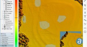
As the industry progresses, drone mapping tools are getting more and more sophisticated. Canadian mapping software company SimActive has traditionally been a leader in mapping for images from satellite and airplane; now they’ve added drone images to their offering. The latest version offers advanced editing tools to perfect the product …
Read More »
9:18 am
Correlator 3D, Drone, drone data, drone mapping, Drone News Feeds, Feature 1, News, SimActive
image courtesy SimActive Canada-based SimActive isn’t just a drone company. But as one of the global leaders in photogrammetry, SimActive sees drones as a key element in democratizing mapping data. In 2003, when Philippe Simard and his younger brother Louis started SimActive, the Canadian army was engaged in Afghanistan, mapping …
Read More »
4:59 pm
Drone, drone mapping, Drone News Feeds, Drones For Good, drones photogrammetry, Feature 1, geospatial data, Midwest Aerial Photography, News, SimActive
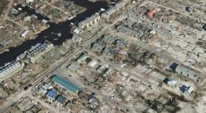
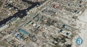
Disaster response efforts following Hurricane Michael have showcased high precision drone geospatial data. SimActive, a world-leading developer of photogrammetry software, partnered with drone service provider Midwest Aerial to perform critical damage assessment of homes and infrastructure after Hurricane Michael struck the Gulf Coast last month. Hurricane Michael destroyed billions of …
Read More »
11:39 pm
3D modeling, Commercial Drones, Drone, drone mapping, drone modeling, drones in construction, News, SimActive
SimActive‘s Correlator3D is one of the tools that enables commercial drone operators to level up and play at the enterprise level. SimActive has been a major player in the creation of photogrammetry solutions from aerial data since 2003. They started by utilizing data from satellites and manned aircraft, and their …
Read More »