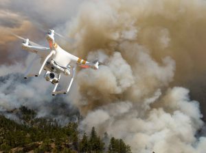
Photo: Bureau of Land Management
The US Department of the Interior has announced a collaboration with industry partners DJI, AirMap, and Skyward in an attempt to keep drones away from wildfires.
In an announcement yesterday, the US Department of the Interior (DOI) says that they have released a prototype warning system with industry partners to provide real-time alerts and geofencing alarms to drone operators, in order to prevent them from flying near wildfires.
“This pilot project makes initial wildfire location data publicly available to commercial mapping providers that support UAS operations, alerting drone pilots before they enter air space over an active wildland fire,” said Mark Bathrick, the director of Interior’s Office of Aviation Services. “No responsible drone operator wants to endanger the lives of the men and women who work to protect them and we believe this program, which uses the global positioning system to create a virtual barrier, will move us one step closer to eliminating this problem for wildfire managers.”
The system was developed with DJI, the world’s largest drone manufacturer, and AirMap and Skyward, leading providers of “airspace intelligence” for drones. AirMap and Skyward are now integrated with the DOI’s Integrated Reporting Wildland-Fire Information (IRWIN) program, and can immediately pass data to drone operators through AirMap’s iOS and web apps, AirMap’s API, and the GEO geofencing system, part of the DJI GO flight control app. DJI announced earlier this month that the GO app would include improved data on changing situations such as wildfires.
“Privately flown drones pose serious risks to firefighting planes and helicopters because these support aircraft fly low and slow, in smoke-obstructed areas, and their pilots are preoccupied with positioning to release water or fire retardant,” says the DOI announcement. “When drones enter air space over or near wildland fires, they force managers to either delay or cease aerial suppression operations, impeding efforts to control and contain these destructive blazes and placing firefighters and the communities they protect in greater danger.”
Drones near wildfires have been big news in recent months, as firefighters repeatedly complained of drones. In Utah, the governor has responded by passing new legislation increasing the penalties for flying near fires or impeding firefighters; and has made it legal for authorities to down a drone sighted in an unauthorized area.
Geofencing has been used for some time to inform operators of restrictions around other sensitive areas like airports and prisons. DOI says that they hope to expand the program before next year: “Experience and data obtained from this year’s prototype will be used to inform a full public and industry release planned for the 2017 fire season. In the future, the system will have the capability to prevent drones from operating in restricted airspace once they reach a geofence perimeter.”
Source link
 Unmanned Aerial Vehicle The latest drone news


