
Guyana gets drones from FAO to enhance precision farming in rice production
Kaieteur News – Under the China South-South Cooperation Programme, the Food and Agriculture Organization of the United Nations (FAO) is supporting the Guyana Rice Development Board’s efforts to advance technology in the rice industry.
The project commenced with the handing over of five drones and related software and accessories to the GRDB along with two weeks of training on the use of the new equipment. In a press release, the FAO said it is an initiative in response to recovery from the impacts of COVID-19 for countries of the Community of Latin American and Caribbean States (CELAC).
The main aim is to support rural livelihoods and food systems so that smallholder farmers in rural communities can increase their competitiveness. Introducing drones and a geographic information system (GIS) mapping in Guyana will allow rice farmers to comprehensively monitor their production plots during the various growth phases in a timely manner and provide data for key decisions needed to improve and advance rice production, the FAO said.
Agriculture Ministry officials
“We have completed two weeks of training to fly the drones, this will help me and my colleagues with data collection and monitoring of rice fields so that we can give farmers real-time advice to make good decisions as it relates to their crops,” Quacy Wilson, Extension Officer of Region Five related.
GRDB Extension officers from Regions 2, 3, 4, 5, and 6 attended the training. In the first week, virtual training was done to cover the theory of unmanned aerial systems (UAS) hardware, applications, maintenance, and preflight planning. The second week entailed in-person training which covered areas of safety guidelines, maintenance, mission planning and execution, best practices for UAS operation, practical flight training, and handling emergencies and data management.
The training was facilitated by OIKO- a consultancy firm out of Spain, that has partnered with two consulting firms. The first is Open Plan, an international consultancy specializing in geospatial analysis planning policy development, and capacity building in the public sector. The second is GISCAD, a leading provider of GIS-related services in the Caribbean. It has been supporting institutional capacity building in the region to enable ministry officials to understand and operate high-technology geospatial analysis software and UAS, as well as participatory GIS mapping.
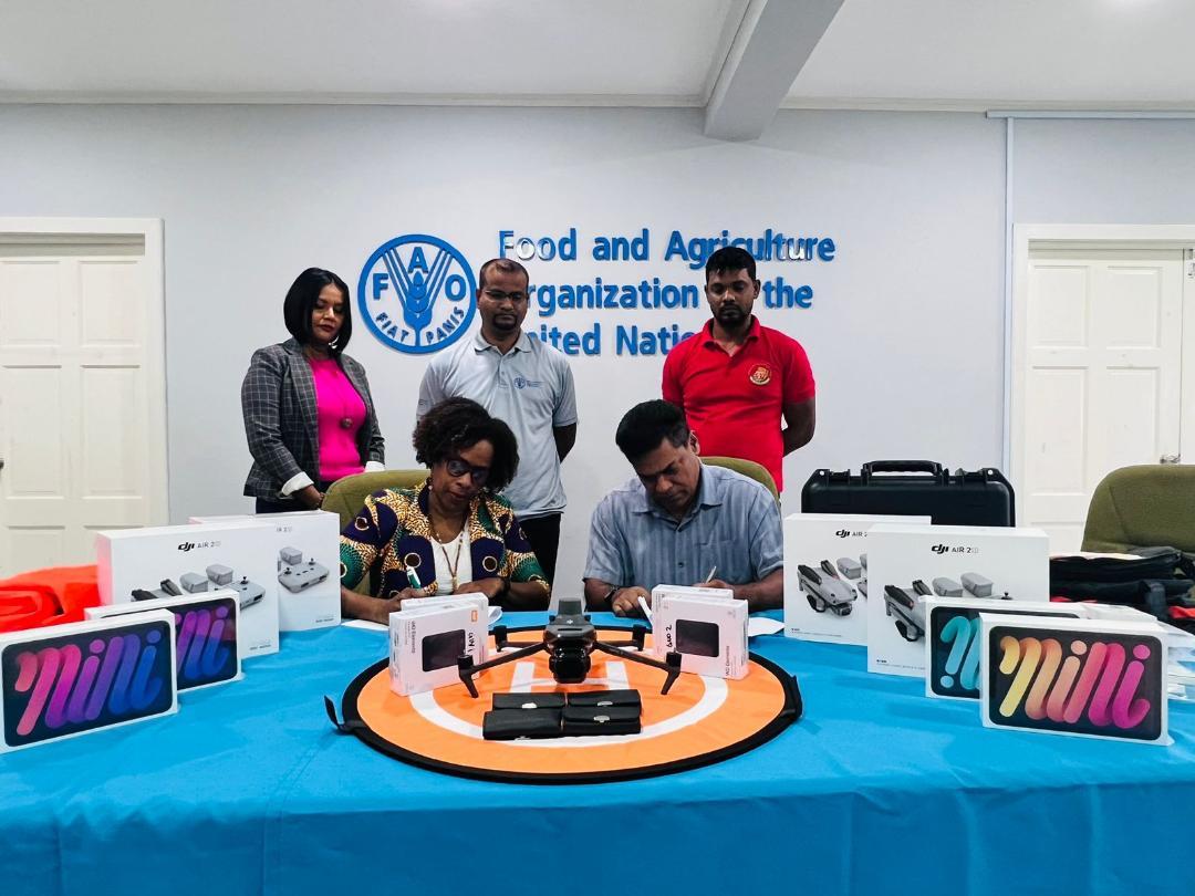
The FAO hand over five drones and related software and accessories to the GRDB
The knowledge and skills necessary to operate UAS safely will help to monitor rice cultivation to collect detailed information on crop establishment, plant health, crop type, and crop growth stages. It will also help with land, water, and fertilizer usage and further help to assess impact in the event of a disaster.
The data gathered from drone monitoring will help to enhance production practices, aid in the efficient use of resources, and overall, support management decisions to improve yields and livelihoods.
At the end of the training, participants will fly the drones and map between 200 to 500 acres in their respective regions. The data collected through this assignment will be used as raw data in the next stage of this project which focuses on data analysis and participatory GIS. This training will commence on September 25, 2023, and will include an additional 12 officers from the GRDB Extension and Research departments. In the final phase of this project, GRDB through its Farmers Field School (FFS) Programme, will train farmers on the integration of this technology into their farming practices. Farmers will be able to see how data is captured by drones and can be used to improve crop management.


