 Drone flights are helping an Idaho county maximize the use and sustainability of its landfill.
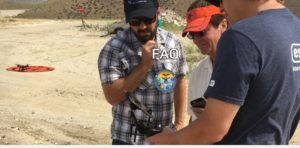
Ada County recently received FAA approval to launch drone flights over its 2,700-acre multi-use complex to map the site to measure erosion and ground swell as well as to ensure proper distribution of landfill dirt.
The COA allows the county’s IT department to operate a 3DR quadcopter equipped with a GoPro camera to fly daytime missions up to 400 feet.
“By comparing and contrasting image differences from one flight to the next, landfill operators can accurately calculate volume and elevation changes,” a county press release stated. “Future uses of UAS at the landfill include hot-spot detection (gas leaks), mapping, classification and approximation of the amount of different types of materials in the landfill.”
In a typical year, the landfill receives around 400,000 tons of waste from four cities and four government agencies.
Imagery collected by the drone will be cheaper, higher-quality and more timely than aerial or satellite imagery. The county currently pays $20,000 per manned flight. Drone images will be processed by high end software to create 3D models, digital elevation models and stitched images that can be imported into GIS for analysis.
Ada County deputy solid waste director Ted Hutchinson tells Waste 360 that the county may add GPS devices to the landfill compactors and other equipment that will provide information to be integrated into the drone-based data system.
“The idea of using this new technology which is less expensive and, therefore, more accessible to provide aerial mapping appeared to be a logical fit,” Hutchinson added. “Using a drone would provide us the opportunity to have more data, more often. Having this data will aid us in short-term and long-term planning for maximum airspace utilization.”
Landfill mapping flights are nothing new. Two years ago, the FAA approved a request by the Mesa County Public Works Department in Arizona to fly a Trimble UX5 drone “to determine volumes and compaction of its county landfill and survey and monitor infrastructure projects.” The Trimble UX5 is an unmanned fixed-wing aircraft that captures high-resolution images during flight, which is typically up to 50 minutes covering as much as 2.3 square kilometers (approximately 1 square mile) when flying 120 meters (approximately 400 feet) above the ground.


