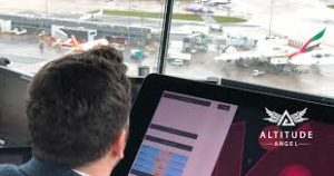
Drones can be a critical tool for responding to natural disasters like wildfires or floods – but if not carefully coordinated they also risk interfering with manned aircraft working at the same scene. To add to the confusion of a natural disaster, ground-based communications networks are often the first infrastructure to go down: and UTM platforms, tools which allow response teams to identify air traffic and manage potential conflicts, typically rely upon these networks like cell towers to work. Now, U.K. – based unmanned traffic management (UTM) provider Altitude Angel has announced that their UTM platform will be available via satellite. This means that the tool can be used at anytime, anywhere.
Phil Binks, Head of ATM at Altitude Angel, explains how disaster response teams might use Altitude Angel to avoid conflict between multiple airborne resources. “To ensure safety is not compromised, by deploying a tactical deconfliction service we can provide UAVs with the information on conflicting traffic or changes to airspace access whilst the UAV is in flight. If opposing traffic is deemed to be ‘in confliction’ then appropriate and timely instruction can be given.”
Making the tool available by satellite expands the availability of Altitude Angel’s platform to the places it may be most needed. “The advantage of using this space-based capability is the reliance on ground based technology to maintain a UTM (U-Space platform) is negated,” says Binks. “In remote parts of the world or areas devastated by natural disaster unmanned technology can still be utilised, supporting manned aviation.”
The following is an Altitude Angel press release.
PLATFORM WILL GIVE ‘BLUE LIGHT’ SERVICES THE ABILITY TO CO-ORDINATE UAV AND MANNED AVIATION ACTIVITY IN DISASTER ZONES SAFELY AND SECURELY
London, UK; Altitude Angel, the world’s leading UTM (Unmanned Traffic Management) technology provider announces today the general availability of its UTM platform via popular satellite constellations, bringing critical airspace situation awareness and conflict resolution to remote areas and those affected by natural disasters anywhere on the planet, at any time.
UTM services are typically dependent on the appropriate ground-based communications network infrastructure, such as cell towers, in order to send and receive instructions and tracking information from drones. In the event of a natural disaster, such as a flooding, wildfire, tsunami, earthquake or volcanic eruption, safe operation of multiple drone flights is compromised as this ground infrastructure isn’t resilient, or in the case of remote areas, not available.
However, the combination of Altitude Angel’s UTM technology platform, which now includes the world’s first tactical Conflict Resolution Service available via a UTM platform at scale, when used in conjunction with partner satellite networks, will allow any lead organisation or agency to deploy an instant UTM platform for the safe operation of drones in even the most challenging of environments. It will also provide the essential coordination of aerial unmanned and, if necessary, manned aviation assets.
Offering response agencies and drone manufacturers who specifically build drones for deployment in assisting emergency services the choice of multiple communications links, including satellite communications, is a major step in ensuring a UTM service can operate even in the toughest scenarios.
When ground-based communications have been damaged and roads are impassable, the need for numerous organisations to operate multiple drone flights safely over the affected area increases. Each need to perform different operations; for example, one agency using drones will need to find survivors, a second surveys roads ahead of relief supplies being delivered whilst a third searches for potential hazards. The Altitude Angel space-based solution will allow the safe management of these flights, right out-of-the-box at any point across the planet.
Richard Parker, Altitude Angel, CEO and founder said: “The opportunities for the instant space-based UTM service are wide-reaching and numerous, but this system will be invaluable to aid organisations and those co-ordinating the emergency services, and relieve operations following something like a natural disaster where first-responders are more often turning to unmanned aircraft to assist. We are proud to make our UTM services available for free to all first responders in times of need.”
Phil Binks, Altitude Angel, Head of Air Traffic Management, added: “The platform we’re offering to first responders will bring clarity to what previously could be a confusing air picture. As we have seen recently with both the flooding across the UK and wildfires in the United States and Australia, unidentified UAVs spotted in affected areas have caused the emergency services to ground rescue helicopters and airtankers, costing valuable time, whilst the operator is identified.
“However, many of these sightings are subsequently found to be of drones being operated by the emergency services. What we’re seeing here are different agencies with different primary objectives. Whereas one group may be focusing on putting a fire out, another may be looking for fires starting. This system will allow ‘blue light’ flights to continue in tandem with UAV operations, safely and securely.”
In order to provide emergency services and first responders with the ability to have a single source point-of-truth where UAVs and manned aviation can be co-ordinated on the same platform, engineers at Altitude Angel were able to adapt existing services to work on higher latency/lower bandwidth networks and to enable ‘mode switching’ to ensure a robust communications link with deployed vehicles is always maintained.
Miriam McNabb is the Editor-in-Chief of DRONELIFE and CEO of JobForDrones, a professional drone services marketplace, and a fascinated observer of the emerging drone industry and the regulatory environment for drones. Miriam has a degree from the University of Chicago and over 20 years of experience in high tech sales and marketing for new technologies.
For drone industry consulting or writing, Email Miriam or (for paid consulting engagements only) request a meeting through AdvisoryCloud:
TWITTER:@spaldingbarker
Subscribe to DroneLife here.
https://dronelife.com/2020/03/09/drones-for-good-altitude-angel-releases-instant-tactical-utm-for-disaster-response/


