Commercial drone solution provider Delair this week announced the release of an new integration to its Trimble Business Center software.
The integration enables geospatial professionals to drag and drop data from the Delair UX11 PPK drone system directly into Trimble Business Center projects.
Users can combine high-quality flight data with other sensor data to create vivid orthomosaics and accurate surface models.
The integration builds on collaboration between the two companies that includes Delair’s acquisition of the Gatewing drone business from Trimble in 2016.
“We have a long and proven track record of working with Trimble and its comprehensive solutions for geospatial professionals. The integration of data from the Delair UX11, which has its roots within Trimble and the Trimble Business Center workflow, is a natural extension of our relationship, delivering the most complete and efficient UAS solution for mapping and survey customers,” said Chase Fly, Geospatial Product Manager at Delair.
The Trimble Business Center v5.0 JXL file format interoperability streamlines the processing of high-precision drone data, supporting high-precision horizontal and vertical locations as well as accuracy estimates for the PPK positions. The collected data is then is available with the Delair UX11 PPK, Delair After Flight v6.0.7 and Trimble Business Center v5.0.
In November, the company launched a new drone model focused on the agriculture industry — the UX11-Ag. Built on the company’s current UX11 fixed-wing drone, the new version combines the productivity benefits of long-range/BVLOS flight operations with highly accurate survey-grade mapping and plant data collection capabilities.
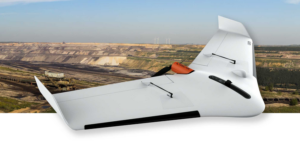
In April, Delair announced the global availability of the UX11 fixed-wing UAV following a round of final tests, a move that allows the company to set its sights on the growing mapping/surveying drone sector catering to industrial-level markets – construction, oil and gas, utilities, mining, agriculture and transportation.
In June, Delair inked a sales agreement with Cansel, a Canadian provider of surveying and mapping solutions. The deal directs sales of the UX 11, with plans to include the company’s full product line. The agreement also means Delair fixed-wing drones are now certified as compliant by Transport Canada.
Jason is a longstanding contributor to DroneLife with an avid interest in all things tech. He focuses on anti-drone technologies and the public safety sector; police, fire, and search and rescue.
Beginning his career as a journalist in 1996, Jason has since written and edited thousands of engaging news articles, blog posts, press releases and online content.
Email Jason
TWITTER:@JasonPReagan
Subscribe to DroneLife here.
https://dronelife.com/2019/01/20/delair-expands-drone-data-integration-with-trimble-software/


