7:26 am
DL Exclusive, Drone, Drone News, Drone News Feeds, News, Urban Air Mobility
Two years ago, in November of 2020, the Mayor of Seoul took a ride in an EHang 216. The autonomous test flight was launched over the densely populated city of Seoul, under a “Special Certificate of Airworthiness,” the first ever granted in Korea to a passenger-grade AAV. passenger flight experience …
Read More »
3:25 am
Applications, DL Exclusive, Drone, Drone News, Drone News Feeds, News
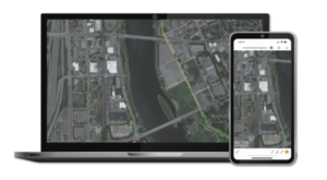
At South Korea’s major GIS and mapping show, Smart Geo Expo: new software, new drone options. Drones and mapping applications are truly global, and DRONELIFE has been visiting shows on 3 continents this fall to find new solutions from every corner of the world. On the floor of Smart GEO …
Read More »
7:20 am
DL Exclusive, Drone, Drone News, Drone News Feeds, Drones in the News, News
At the SmartGeo Expo in Seoul today, the Korean Institute of Aviation Safety Technology (KIAST) signed a ground-breaking MOU with the Ethiopian Ministry of Urban and Infrastructure Development (MUID) to advance drone mapping in Ethiopia. The project will be led on the ground by Korean drone-based geomatic and survey experts …
Read More »
11:06 pm
DL Exclusive, Drone, Drone News, Drone News Feeds, Drones in the News, Feature 1, News
The AUVSI NE UAS and AAM Summit, held at the Northeastern University Innovation Campus, took place last week with an impressive lineup. Continue reading below, or listen: Among the speakers offering a rare opportunity for an open discussion was Lt. Col. Thomas F. Meagher, Division Chief, AFWERX Prime, Department of …
Read More »
2:41 pm
DL Exclusive, Drone, Drone News, Drone News Feeds, Feature 1, News
Steve Lynes from Sandshurst, United Kingdom, CC BY 2.0 It’s one of the conundrums of the drone industry: autonomy is necessary to maximize the benefits of uncrewed systems. Anyone who has watched a science fiction movie or read the news, however, understands that a high level of autonomy comes with …
Read More »
2:35 pm
DL Exclusive, Drone, Drone News, Drone News Feeds, News, Products
At last week’s INTERGEO show in Essen, Germany, companies from around the world showcased mapping tools from new drone hardware to new mapping software. We met with our friends at Blue Marble Geographics to see what the newest version of Blue Marble Global Mapper has to offer for customers. Cintia …
Read More »
6:11 pm
data analytics, DL Exclusive, Drone, Drone News, Drone News Feeds, News, Products
INTERGEO, held this week in Essen, Germany, is positioning itself as the leading global platform for GIS IT. INTERAERIAL Solutions is the section of the show featuring drone solutions: an increasingly important sector of the GIS industry. Many mapping service providers work in one arena or the other: using …
Read More »
6:03 pm
DL Exclusive, Drone, Drone News, Drone News Feeds, Drones in the News, Feature 1, News
DRONEII at INTERGEO 2022 DRONELIFE always looks forward to hearing what global drone market researchers DRONEII have been working on. The firm are leading industry analysts: studying the forecasts, fleets, use cases, regional differences and challenges facing the UAV industry. At this week’s INTERGEO GIS and mapping expo held in …
Read More »
5:51 pm
DL Exclusive, Drone, Drone News, Drone News Feeds, News, Products
INTERGEO – one of the largest GIS and mapping shows in the world – is back and in person this week, in Essen Germany. DRONELIFE is on the floor at INTERGEO and the INTERAERIAL Solutions section of the show, dedicated to the drone technology powering mapping applications around the globe. …
Read More »
2:53 am
DJI, DL Exclusive, Drone, Drone News, Drone News Feeds, News
DroneDeploy has been one of the top names in drone mapping since they started in 2013. They’ve evolved with the industry: and now, DroneDeploy goes beyond drone mapping to unified reality capture – allowing customers to gather data from multiple sources, aerial and ground, to get the intelligent insights they …
Read More »