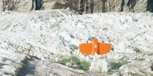
Source: WingtraOne Orthophoto survey drones are providing new insights to scientists tracking ice and water levels in Alaska. A research team led by Gabriel Wolken of the University of Alaska Fairbank’s Climate Adaptation Science Center has been measuring rising and falling ice and water levels in Suicide Basin glacial lake …
Read More »Orthophoto Survey Drones Help Predict Flash Flooding