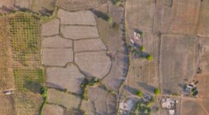
Drone Mapping of UNESCO Archaeological Site: From Simactive Drones mapping of UNESCO Archaeological sites are helping to gather the necessary data to help prepare orthophoto maps and digital elevation models of valuable areas. The drone mapping company SimActive recently announced that it is involved in the mapping of a UNESCO …
Read More »
Breaking News
- Metro announces pilot program to place more drones in servic…
- Oppose the firing of Google workers for protesting tech gian…
- Vertical Flight Technology Leaders Head to Montreal for 80th…
- Bangladesh to introduce remote sensing, drones to detect cro…
- Israel’s advanced military technology on full display during…
- Has DJI found a way to beat US drone ban?
- Bangladesh set to introduce drone tech to assess crop losses
- Ukraine unveils new kamikaze drone with a design similar to …
- G7 Leaders Declare Solidarity For Israel: Allies Help Interc…
- Inside the changing world of drone warfare
 Unmanned Aerial Vehicle The latest drone news

