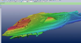
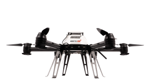
Eos Systems recently released a photogrammetry software package created specifically for drones. This past week, the Canadian firm announced the launch of PhotoModeler UAS 2016. The suite creates 3D imagery, maps and measurements from images transmitted via drone and integrates them with full geographic coordinate systems support. “Photogrammetry has been …
Read More »Eos Launches Photogrammetry Suite