
Napoleon Bergstrom, GLOBHE Deputy CEO and COO
GLOBHE: Scaling Access to Actionable Drone Data
All images used with permission, courtesy GLOBHE.
Stockholm-based startup GLOBHE was started only 7 years ago – but they have already achieved a place in the Guinness Book of World Records (largest album of drone-collected images) and on the global stage of impact tech companies, those companies addressing major environmental or social issues through the intentional and responsible use of technology.
Continue reading below, or listen:
“GLOBHE is short for Global Health: that’s what we want to achieve, and that’s what we stand for,” says GLOBHE COO and Deputy CEO, Napoleon Bergstrom. “We are helping companies by providing something critically important – that’s data.”
Founded in 2015 by industry visionary Helena Samsioe, in 2019 the company made a major move towards scaling access to drone data that can be used for environmental protection, disaster relief and prevention, community planning and more. GLOBHE’s marketplace platform connects customers to local drone operators in over 129 Countries: the marketplace boasts 6,600 drone operators currently, and is growing daily. That means that customers can get data products which enable them to understand a location without going there, through orthomosaic data, 3D models, terrain models and more.
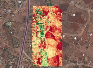
Measuring plant health
Unlike other pilot networks, GLOBHE’s crowd droning concept puts expert eyes on the job specifications and the finished product, so that customers know the data products they receive will meet their needs.
“ A customer makes a request for data by uploading a file or drawing on a map,” Bergstrom explains. “This gets evaluated, and then local operators are invited to the project. The pilot gets the appropriate permissions and flies the mission, processes it in their product of choice, and uploads the processed data to the Crowdroning platform. That processed data is verified for accuracy and alignment with the client requirements, and can be delivered in the platform.”
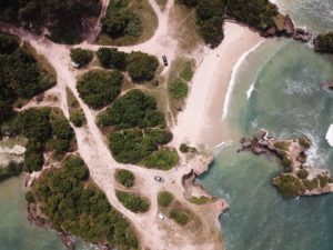
Coastline in Tanzania
Bergstrom calls the crowd droning concept “like Uber for drone data,” and like the ubiquitous Uber, it has major advantages for both customers and pilots in all areas of the world. Without the need to transport drones, pilots and equipment, the model is more sustainable: and it provides valuable business opportunities and skills transfer. “We’re enabling drone operators to get paid work through our platform, and we’re enabling global customers to get data through a single vendor,” says Bergstrom. “What we sell is availability in 129 countries, and ease of use.”
GLOBHE Drone Data
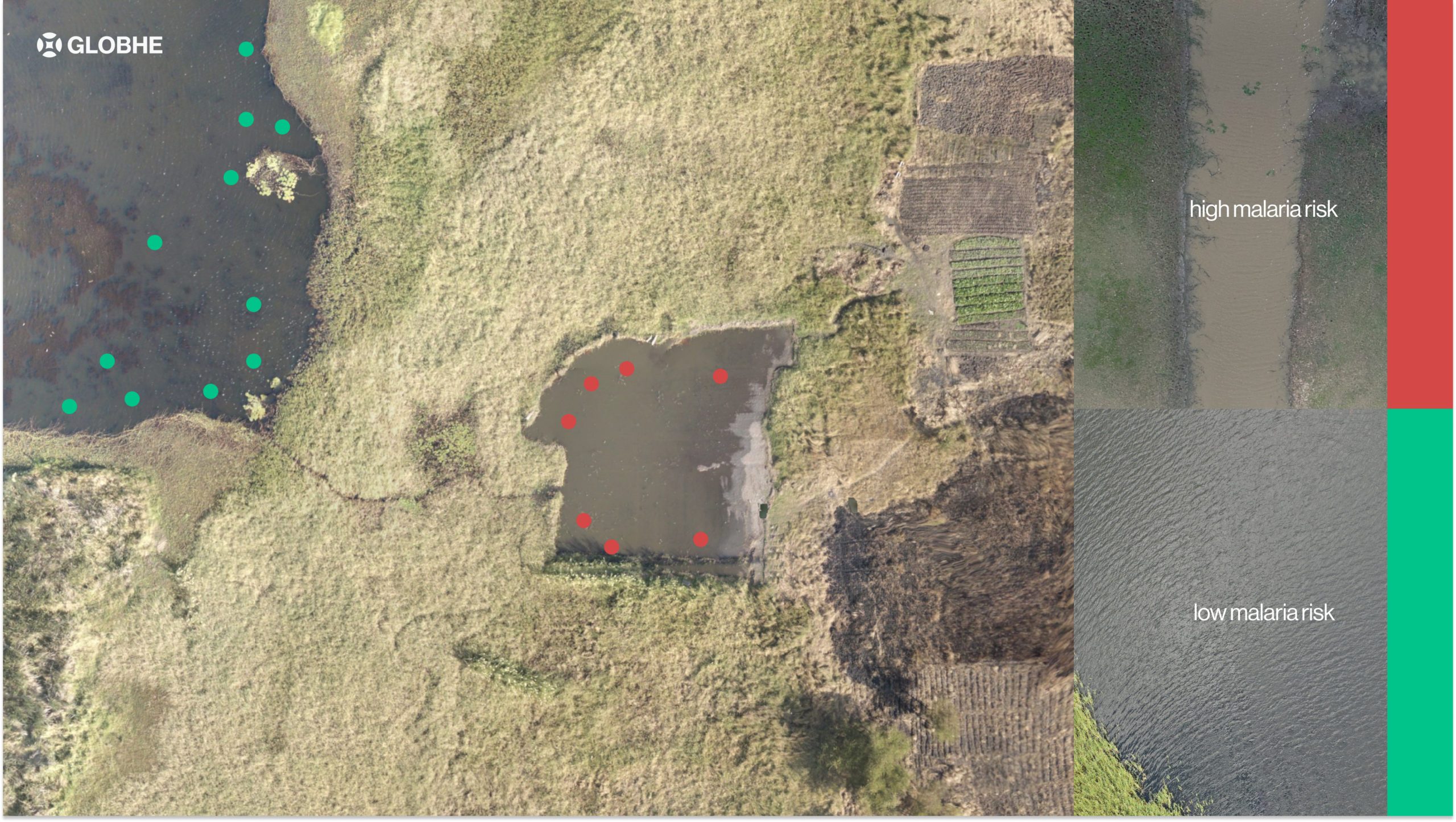
For both commercial and non-profit customers, it’s a compelling value proposition – and the projects that GLOBHE has facilitated make a significant contribution to solving global issues. The applications are fascinating: in Malawi, GLOBHE operators are collecting data from 4 different cities to provide elevation maps and terrain models which will facilitate flood modeling analysis. In another project, they are helping to track the breeding areas of the most dangerous animal on earth – mosquitos. Combining drone data projects and AI, stakeholders are able to identify the potholes where mosquitos lay eggs and eliminate them: using fewer chemicals and more effectively managing the spread of malaria.
In Paraguay, they are tracking the health of new forest plantings. In Lesotho, they’re helping investors track the construction and maintenance of new school buildings.
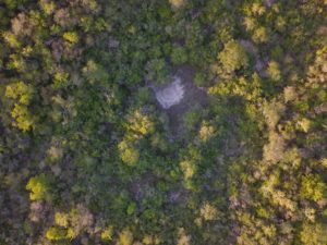
Forest in Paraguay
Other customers are using drone data for more common applications that help democratize access to energy and communications technology, inspecting wind turbines, for example, or telecom towers.
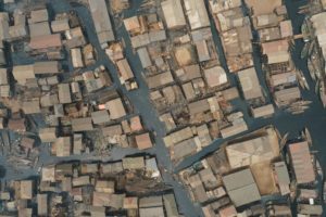
Makoko, Nigeria
With crowd droning, GLOBHE has taken a practical and useful approach to providing global organizations with data. Customers can request a single mission or subscribe for multiple drone flights a month, allowing them to track environmental impact over time or monitor a construction project.
As data products get more sophisticated and machine learning more critical, the company’s newest product is amplifying the value of the global data they’ve already collected. The GLOBHE Data Library is a library of existing data for training AI models, or for comparison with current data. This data covers all of the continents on earth – including Antarctica – making it an incredible resource for companies, environmental scientists, logistics experts, or anyone who wants to understand a corner of the world they’ve never seen before.
Read more:
Miriam McNabb is the Editor-in-Chief of DRONELIFE and CEO of JobForDrones, a professional drone services marketplace, and a fascinated observer of the emerging drone industry and the regulatory environment for drones. Miriam has penned over 3,000 articles focused on the commercial drone space and is an international speaker and recognized figure in the industry. Miriam has a degree from the University of Chicago and over 20 years of experience in high tech sales and marketing for new technologies.
For drone industry consulting or writing, Email Miriam.
TWITTER:@spaldingbarker
Subscribe to DroneLife here.
https://dronelife.com/2023/01/06/globhe-the-impact-tech-company-capturing-drone-data-in-every-corner-of-the-world/


