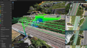
Pix 4D is expanding their enterprise toolset beyond their mapping roots – although the Pix4DMapper platform continues to evolve and improve, staying out ahead of the curve in accuracy and processing time. Now, the company announces the addition of a totally new generation of tools to the Pix4D suite: Pix4Dsurvey, …
Read More »Pix4D Launches Next Gen Suite of Tools [Video]