Courtesy: NBEC
A collaboration between one of Britain’s major radar companies and a group of drone researchers is improving the nation’s unmanned aerial traffic systems.
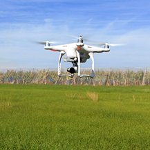
Radar specialist Aveillant partnered with the National Beyond Visual Line of Sight Experimentation Corridor in December to trial a unique holographic radar technology. The test will determine how manned and unmanned aircraft can best share the skies.
NBEC is a research collective and test site sponsored by Cranfield University, Blue Bear Systems Research, Thales (Aveillant’s parent company) and Vodafone. Aveillant radar systems are being used at several international airports to prevent rogue drones from entering flight paths.
The NBEC testing area stretches 10 miles from Cranfield’s global research airport. Officials say it will be open for use by the aerospace industry later this summer.
Aveillant’s holographic radar system differs from traditional radar systems. It only requires a narrow bandwidth. That improves detection performance against multiple targets. The system can also digitize the entire volume of airspace it scans.
“The radar successfully detected and tracked a number of different drones, with excellent correlation between the detected and real tracks,” Aveillant CEO Dominic Walker said. “This test proves and de-risks the technology which will underpin the NBEC airspace monitoring.”
“NBEC is a national asset that will help unlock the potential of a modernized UK airspace,” Cranfield’s Director of Aerospace Iain Gray said. “The key to future drone operations is not segregation, but full integration, ensuring fair and equitable use of airspace.”
The consortium announced the opening of the NBEC in 2018.
“The UK drone industry is going through an exciting evolution and is poised for growth,” Blue Bear Managing Director Ian Williams-Wynn said. “Operation under beyond visual line of sight, alongside co-operative and non-cooperative air traffic in a managed environment, provides a unique opportunity to maintain the UK at the forefront of drone application development and future adoption.”
Last year, Cranfield University researchers launched a smartphone app that connects off-the-shelf drones and allows them to be sent autonomously to inspect multiple locations using coordinates received by text messages.
The app – designed for Android phones coupled with the majority of DJI drones – receives waypoints via text message, compiles the mission and sends standard off-the-shelf (commercially available to the general public) drones on autonomous missions with no user intervention required.
Jason is a longstanding contributor to DroneLife with an avid interest in all things tech. He focuses on anti-drone technologies and the public safety sector; police, fire, and search and rescue.
Beginning his career as a journalist in 1996, Jason has since written and edited thousands of engaging news articles, blog posts, press releases and online content.
Email Jason
TWITTER:@JasonPReagan
Subscribe to DroneLife here.
https://dronelife.com/2020/02/03/new-radar-system-can-track-drones-in-3d/


