The California Air National Guard‘s 195th Airlift Wing recently launched a drone reconnaissance mission to aid firefighting efforts in northern California.
At least six people have been killed by the raging wildfires with more than 500 homes and buildings decimated.
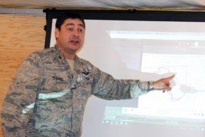
The unit deploys a MQ-9 Reaper drone to monitor and track the blaze. The drone flights collect data, imagery and telemetry which is transmitted to state firefighting officials.
“We’re able to provide real-time eyes on in any area where the fire’s at,” said Air Force Maj. Nicholas Edwards, intelligence analyst manager. “We can provide information to where CAL FIRE can direct resources. We give information to the decision makers in a timely manner.”
The Guard’s contributions are “seriously helping us,” said Capt. Robert DeCamp, CAL FIRE intelligence officer. “The knowledge they have and the information they provide are critical for us to fight the fire. They have equipment we don’t have, and that helps us tremendously.”
Drone data helps track the fire’s movements, so authorities can position defenses and notify the public if evacuations are necessary.
“This is one fire that’s very unpredictable, but we can track it with the capabilities the Guard provides us,” DeCamp said.
Over the past few years, drones have been embraced by both firefighting agencies and by officials seeking to mitigate wildfire damage.
In March, New Hampshire-based Birdseyeview Aerobotics won a federal contract to provide 50 vertical-takeoff-and-landing, fixed-wing drones to the U.S. Interior Department, an agency that oversees millions of acres of public land and administers several monuments.
“These new fixed-wing aircraft are another weapon in our arsenal as we remain committed to preventing the spread of catastrophic wildfires,” said U.S. Secretary of the Interior Ryan Zinke. “The UAS program continues to leverage technology to fight fires in safer and more efficient ways to ensure we are protecting the public, local communities and the men and women on the fire line.”
In 2016, Canadian drone company Aeromao partnered with the U.S. government to survey and map fire-damaged land. Using the $9,000 Talon – equipped with a Micasense Rededge multispectral imagery array – researchers are able to map acreage and survey damage to foliage. That data can then be used to re-introduce wildlife and domestic mammals to viable land after the fires.
Jason is a longstanding contributor to DroneLife with an avid interest in all things tech. He focuses on anti-drone technologies and the public safety sector; police, fire, and search and rescue.
Beginning his career as a journalist in 1996, Jason has since written and edited thousands of engaging news articles, blog posts, press releases and online content. He has won several media awards over the years and has since expanded his expertise into the organizational and educational communications sphere.
In addition to his proficiency in the field of editing and writing, Jason has also taught communications at the university level and continues to lead seminars and training sessions in the areas of media relations, editing/writing and social media engagement.
Email Jason
TWITTER:@JasonPReagan
https://dronelife.com/2018/08/08/national-guard-launches-drone-missions-to-fight-california-wildfires/


