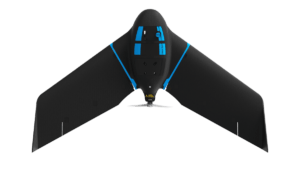
senseFly, one of the leading companies in fixed-wing mapping drones, has announced a new product in their line of professional mapping drones: the eBee Geo.
eBee drones are well-known for their unique, incredibly lightweight construction. Their exceptional safety design, combined with flight endurance and sophisticated payload, have made the eBee a leading choice for long range mapping projects around the world.
A lower-priced, easy-to-use option, “eBee Geo represents the first extension into a new eBee X series of fixed-wing drones and is positioned as a cost-effective option for surveyors and GIS professionals who may be unfamiliar with fixed-wing drone mapping and data collection,” says a senseFly press release.
senseFly’s eBee X solution offers an Endurance Extension option which can enable 90 minute flight time and “single-flight coverage of up to 500 ha at 122m (1,236 A at 400 ft.),” says senseFly, including on-demand RTK/PPK for accuracy of down to 1.5 cm (0.6 in), without ground control points.
Not every mission needs that kind of distance, however – and for shorter range missions, the new eBee Geo offers a still considerable maximum endurance of 45 minutes, single-flight coverage of 160 ha at 122 m (395 A at 400 ft). With it’s lower price point, eBee GEO is perfect for smaller surveying firms and drone service providers. “Operators across a range of verticals including construction, urban planning and land management can also benefit from the RGB imaging capabilities of the supplied senseFly S.O.D.A. camera fixed payload, while achieving greater efficiency and absolute accuracy down to 2.5 cm thanks to the eBee Geo’s available Real Time Kinematic (RTK) function,” says the press release.
“From listening extensively to our customers and understanding both their needs and pain points, we recognized a growing demand for a solution like the eBee X, but at a lower price point,” comments Benjamin Pinguet, Product and Solution Manager at senseFly. “The eBee Geo was designed with those needs in mind, offering better flight times, range and precision than quadcopters while also providing an accessible, yet professional, fixed-wing mapping solution.”
eBee Geo still gives customers the benefit of working with senseFly. Owned by Parrot, senseFly is a mature company with a well-developed software and support organization. eBee Geo customers “will also have access to senseFly’s intuitive eMotion flight planning software, technical support and resource offerings, including its in-house team of experts, global distribution network and the newly launched senseFly Academy e-Learning Training Platform and Certified Operator Program.”
Miriam McNabb is the Editor-in-Chief of DRONELIFE and CEO of JobForDrones, a professional drone services marketplace, and a fascinated observer of the emerging drone industry and the regulatory environment for drones. Miriam has penned over 3,000 articles focused on the commercial drone space and is an international speaker and recognized figure in the industry. Miriam has a degree from the University of Chicago and over 20 years of experience in high tech sales and marketing for new technologies.
For drone industry consulting or writing, Email Miriam.
TWITTER:@spaldingbarker
Subscribe to DroneLife here.
https://dronelife.com/2021/02/01/ebee-geo-senseflys-newest-fixed-wing-mapping-drone/


