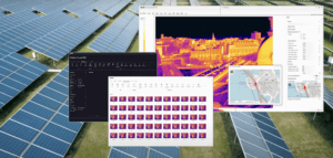
Mapping with Thermal Drones: Teledyne FLIR Talks Best Practices Teledyne FLIR are the world leaders in thermal imaging. Mapping with thermal drones equipped with longwave infrared (LWIR) cameras – whether for solar farm or roof inspections, or for search and rescue or security missions, is getting more critical as drone flight beyond …
Read More »Mapping with Thermal Drones Teledyne FLIR