
 Japan’s HexaMedia has completed a survey of a live volcano, using a drone. The volcanic survey was sponsored by the Japan Meteorological Agency as part of a larger disaster mitigation program.
This article published in collaboration with JUIDA, the Japan UAS Industrial Development Association.
Continue reading below, or listen:
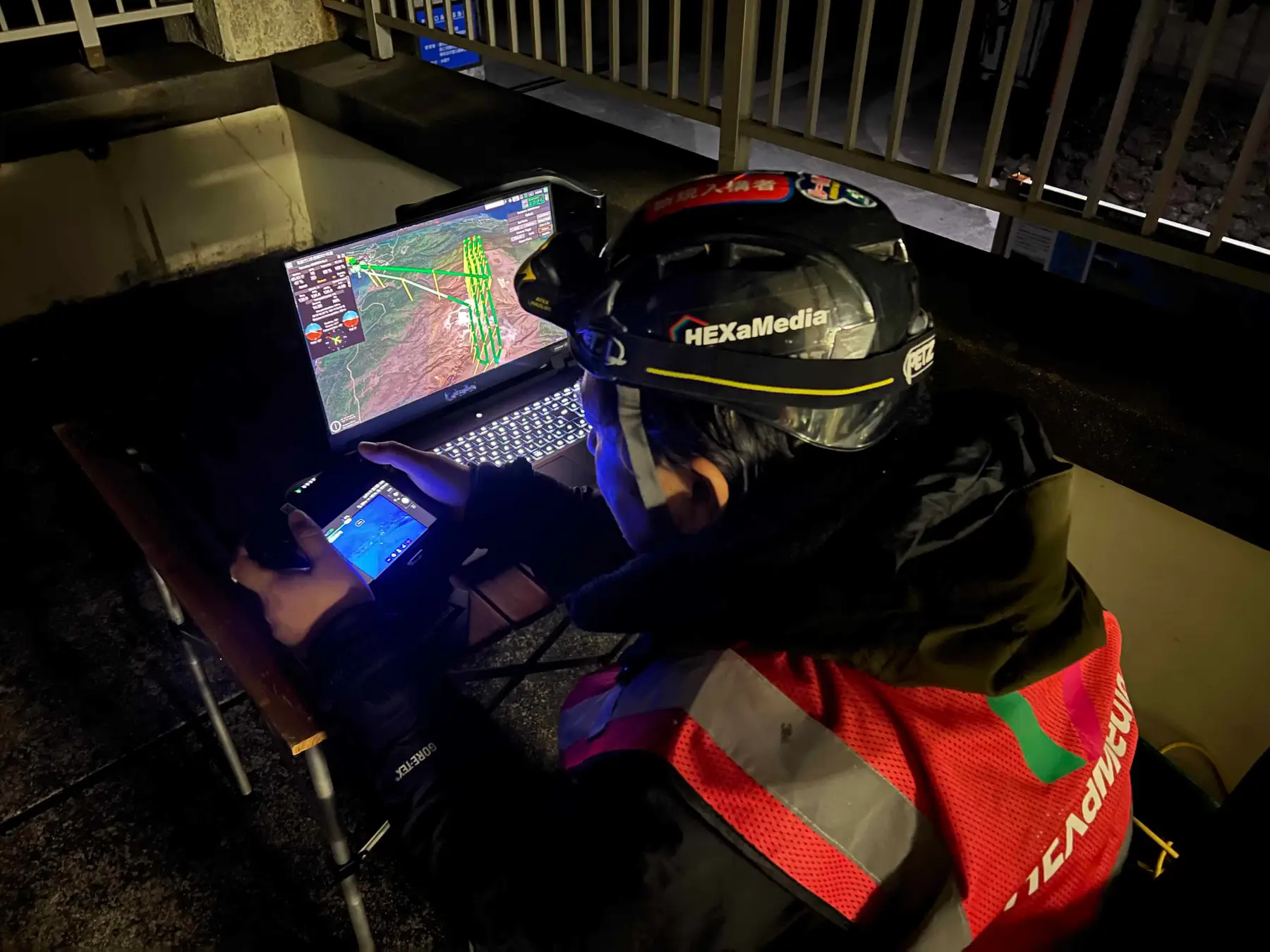
HexaMedia investigated a volcanic crater 2,500m above sea level. The flight was completed beyond visual line of sight (BVLOS), using UgCS for 3-dimensional flight route planning and automatic navigation. HexaMedia completed the mission at night, as sunlight affects the surface temperature of active volcanos.
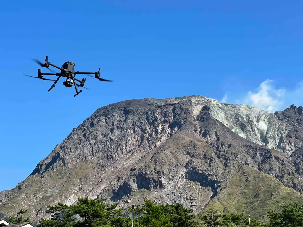
Drone takeoff and landing locations were set up at a safe distance from the volcano, outside the restricted area at the foot of the mountain. “For the first time, Mount Asama was flown at an altitude of 2,568 meters, a maximum flight distance of approximately 4,500 meters one-way, and a maximum altitude difference of approximately 1,700 meters from the takeoff and landing sites,” says HexaMedia.
Operators collected videos and infrared images of the interior of the crater of Mt. Asama, an active volcano in central Honshū, on Japan’s main island. Japan’s Meteorological agency hopes that by monitoring geothermal activities and gathering data to better understand the volcano, communities will have more warning before an eruption or dangerous event.
HexaMedia will continue to conduct volcanic surveys by drone in order to gather more accurate information.
Read more about the Japanese drone industry:
Miriam McNabb is the Editor-in-Chief of DRONELIFE and CEO of JobForDrones, a professional drone services marketplace, and a fascinated observer of the emerging drone industry and the regulatory environment for drones. Miriam has penned over 3,000 articles focused on the commercial drone space and is an international speaker and recognized figure in the industry. Miriam has a degree from the University of Chicago and over 20 years of experience in high tech sales and marketing for new technologies.
For drone industry consulting or writing, Email Miriam.
TWITTER:@spaldingbarker
Subscribe to DroneLife here.
https://dronelife.com/2022/07/11/volcanic-survey-by-drone-hexamedia-completes-mission-in-japan-2500m-above-sea-level/


