

by DRONELIFE Staff Writer Ian M. Crosby
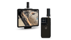
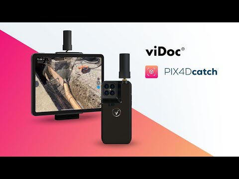
Photogrammetry solutions leader Pix4D has just released the viDoc RTK rover in the USA and Canada. Previously released in Europe, the German-designed rover connects to the latest iOS devices in order to bring RTK accuracy to terrestrial scanning on iPhones and iPads.
The viDoc rover and PIX4Dcatch solution is able to eliminate the need for burdensome and costly survey tools such as RTK GNSS rovers and terrestrial scanners, and is available at a significantly lower price point.
“The viDoc RTK is a very easy-to-use handheld device used to 3D model just about any small area or structure. Combined with processing in PIX4Dmatic with both LiDAR and photogrammetry data, it’s an exciting new and accurate product,” said VerticalAspect’s Mark Paulson, a professional surveyor with 30 years of experience and a decade of experience working with drones and photogrammetry in surveying.
When the viDoc RTK is integrated with the PIX4Dcatch mobile app, the two products form a workflow that transforms iPhones or iPads into an accurate terrestrial scanning device, providing centimeter-accurate RTKpositioning from the user’s existing NTRIP network. Additionally, PIX4Dcatch utilizes LiDARscanners in the latest devices, which are also used during data capture and processing to improve scale and completeness. This culminates in a survey-grade tool in the pockets of professionals, replacing heavy LiDAR scanners and rovers.
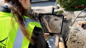
The convenience, output quality, and affordable price offered by the viDoc RTK rover possess the ability to revolutionize the AEC industry and lead new workflows to industries such as public works, accident reconstruction, and stockpile management.


Miriam McNabb is the Editor-in-Chief of DRONELIFE and CEO of JobForDrones, a professional drone services marketplace, and a fascinated observer of the emerging drone industry and the regulatory environment for drones. Miriam has penned over 3,000 articles focused on the commercial drone space and is an international speaker and recognized figure in the industry. Miriam has a degree from the University of Chicago and over 20 years of experience in high tech sales and marketing for new technologies.
For drone industry consulting or writing, Email Miriam.
TWITTER:@spaldingbarker
Subscribe to DroneLife here.
https://dronelife.com/2021/11/03/vidoc-rover-and-pix4dcatch-vidoc-rtk-now-available-in-us-and-canada-for-rtk-accuracy-on-an-iphone-or-ipad/


