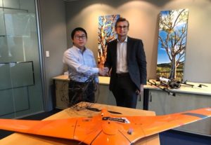
Japanese UAV player Terra Drone Corporation is expanding its global reach after the Tokyo-based company bought a major stake in Australian firm C4D Intel.
Terra Drone specializes in commercial drone hardware, software and UTM. The company focuses on the mining, construction, energy generation, oil and gas sectors, using UAV-based LiDAR and photogrammetry surveying methods.
C4D Intel provides spatial and temporal data acquisition, advanced data processing and decision analytics within the mining, oil and gas, power and forestry industries in Western Australia. The company specializes in enterprise grade surveying and asset inspections using drones.
“This investment presents an opportunity for us to leverage Terra Drone’s expansive international network, technology and experience to propel our growth both within Australia and internationally, particularly in South-East Asia,” C4D Intel Managing Director Alistair Scott-Farris said.
Terra Drone CEO Toru Tokushige said, “There is a strong interest in using technology to revolutionize the way business is done in Australia.”
C4D will immediately start to offer UAV-based LiDAR data acquisition to Australian customers to complement its high-end photogrammetry services. Terra Drone has significant experience with LiDAR, having conducted more than 300 LiDAR- related projects.
Company experts say LiDAR is superior photogrammetry and is particularly “useful for modelling narrow objects such as transmission lines, pipelines, sharp edges and complex infrastructure such as power stations and processing plants.”
Terra Drone will also provide C4D Intel with Robotic Batonomous Systems, a solution for mapping or scanning environments such as in underground mining and inside buildings. Terra Drone Japan gained access to this technology through its investment in Swedish aerial robotics startup Inkonova AB.
As part of the deal C4D Intel will likely change its name to Terra Drone Australia early next year.
“This investment is a strategic move to advance our global footprint, by providing Australian companies access to innovative technology and services that improve safety, productivity and return on investment,” Tokushige said.
Last year, Terra Drone launched new image processing software Terra Mapper to optimize drone surveying services. The platform is an automated drone navigation, image processing, and 3D image analysis program that is available in both cloud and desktop versions.
Jason is a longstanding contributor to DroneLife with an avid interest in all things tech. He focuses on anti-drone technologies and the public safety sector; police, fire, and search and rescue.
Beginning his career as a journalist in 1996, Jason has since written and edited thousands of engaging news articles, blog posts, press releases and online content.
Email Jason
TWITTER:@JasonPReagan
Subscribe to DroneLife here.
https://dronelife.com/2018/12/10/terra-drone-expands-market-after-australian-data-firm-acquisition/


