LiDAR Drone Market LiDAR Drone Market Is Rapidly Expanding Due To Its High Precision In 3D Mapping For Industries Like Construction And Agriculture, Driven By Tech Advancements AUSTIN, TEXAS, UNITED STATES, April 19, 2024 /EINPresswire.com/ — LiDAR Drone Market Overview: The 𝐋𝐢𝐃𝐀𝐑 𝐃𝐫𝐨𝐧𝐞 𝐌𝐚𝐫𝐤𝐞𝐭 is experiencing rapid growth, driven by the …
Read More »Introducing the YellowScan Navigator Bathymetric LiDAR syste…
YellowScan, a global leader and designer of the next generation of manned and unmanned LiDAR solutions, announced the release of its new bathymetric system, the YellowScan Navigator, at CES 2024. We have all witnessed the impact of climate change: drier and warmer seasons, interspersed by heavy rains and flooding rivers. These …
Read More »Censys Technologies Integrates LiDAR into Fixed-Wing VTOL Dr…
Daytona Beach, FL – Censys Technologies Corporation is bringing LiDAR to its list of universal payload options. Censys, a trailblazer in the commercial beyond visual line of site (BVLOS) unmanned aerial systems (UAS) industry, offers a one-of-a-kind remote sensing package to revolutionize the way aerial information is collected for infrastructure, …
Read More »Drone-Mounted LiDAR Brings Fresh Data to State DOTs
Drone-Mounted LiDAR Brings Fresh Data to State DOTs | Engineering News-Record This website requires certain cookies to work and uses other cookies to help you have the best experience. By visiting this website, certain cookies have already been set, which you may delete and block. By closing this message or …
Read More »USING DRONE LIDAR TO COMPLETE AN AS-BUILT SURVEY
Rome, NY, Jan. 20, 2022 (GLOBE NEWSWIRE) — Traditionally, the documentation of As-Built construction surveys relied on conventional methods such as total stations and digital photogrammetry. However, the team at Spatial Data Consultants (SDC), an expert geospatial consulting firm in High Point, North Carolina, is using drone LiDAR technology to …
Read More »RedTail Delivers LiDAR System to DOD’s EOD Community
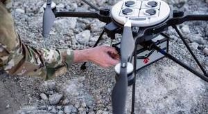
Fairmont, WV, October 4, 2021 — RedTail LiDAR Systems, a leader in microelectromechanical systems (MEMS) mirror-based light detection and ranging (LiDAR) technology, has delivered six LiDAR systems to the 707th Ordnance Company stationed at Joint Base Lewis-McChord. These systems will provide Explosive Ordnance Disposal (EOD) technicians an opportunity to assess how …
Read More »Global LiDAR Drone Market 2019- Scenario by Key Companies, F…
Jun 19, 2019 (The Expresswire via COMTEX) — LiDAR Drone Industry 2019 Global Market research report studies latest LiDAR Drone industry aspects market size, share, trends, growth, business overview and LiDAR Drone industry scenario during the forecast period (2019-2024). The Global LiDAR Drone market 2019 research provides a basic overview …
Read More » Unmanned Aerial Vehicle The latest drone news


