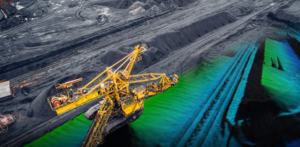
Israeli drone provider Airobotics is digging into new drone applications in the mining sector.
Last week, the company offered a Q&A session with mining technology manager Dan Ward to deep dive into the future of drones and mining.
The interview comes on the heels of a recent distribution partnership with South American mining engineering firm RockBlast. The agreement makes RockBlast the first company to introduce a fully autonomous drone system into South America for the mining industry.
Q: What are the current positive and negative perceptions of digitization and automation amongst mine surveyors?
A: Whilst there is a general perception that the digitization of mining is an inevitable and necessary investment to improve safety and productivity, it is often executed or implemented poorly. Often because the people implementing the digitization strategy don’t fully understand the problems they are solving.
The subject of automation is far more polarizing. Naturally, there is a perception that automation will make some positions redundant. This perception does have some merit as the purpose of automation is to replace tasks. However, a misconception of automation is that it is ‘smart’, when this couldn’t be further from the truth. The tasks that automation replaces are typically mundane, repetitive tasks. Automation thrives in a non-dynamic environment, and in the case of automating data capture, this frees up time for the team on site to focus on analysis and investigation of the data, using human problem-solving skills to address complex challenges.
However, these misconceptions must not be ignored as getting automation right requires a strong focus on people strategies – transforming the business while maintaining an engaged, motivated and appropriately skilled workforce.
Q: What are the main concerns for mine surveyors with the shift towards automation and digitization?
A: I believe the main concerns revolve around becoming redundant, managing QA/QC, and how to manage the workload of day-to-day production surveying while also investing time to ensure all the systems and processes are improved to handle this new influx of data.
Q: Do you think a shift towards automation is different to previous technological changes in the mine surveying industry, such as the introduction of LiDAR?
A: Yes, while previous advances in technology have generally either made the outputs more accurate, faster or higher resolution, the process and workflow principles have remained very much the same. Automation has the potential to redefine the typical role of a Mine Surveyor from one that sets out and captures spatial data, to one that focuses on the analysis of this data for improved decision-making.
Q: How will automation and digitization change the current role and responsibilities of a surveyor? Will they be required to upskill? If so, which skills do you think are most important in adapting to these changes?
A: I think surveyors need to upskill their knowledge in GIS, ensuring robust workflows are set up so that the spatial data is easily digestible by the GIS platforms. It will be an important role of surveyors to unlock the potential of spatial data as it only adds value when it is accurate and assists the decision-making process. I anticipate communication will play a significant role as the surveyor could become the conduit between what have typically been quite siloed departments. Finally, I believe the role of the surveyor could develop into one which can find bottlenecks and correlations between various data sets as the focus shifts to investigating the causation and impact of a situation. As a result, the role of surveyors will potentially evolve to become an Analyst or Business Improvement role.
Q: What will the role of surveyors look like in the next five years?
A: We could end up with two paths for surveyors. One will be part of a technical team on site that will maintain the data capture systems, ensure equipment is calibrated, and capturing the correct areas by integrating into the daily and weekly plans.
The other role I believe will be with the GIS production/analysis team in remote operating centers. The amount of data coming off mine sites is increasing every day, and the GIS teams will be required to manage, archive and analyse. This has the potential to open a new career path for surveyors, transitioning from a service-based role to a value-added role, optimizing and increasing the efficiency of operations.
https://dronelife.com/2019/03/18/qa-airobotics-digs-into-drones-and-mining/


