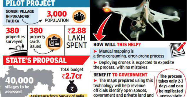
Within a month of using the drones, the settlement commissionerate department was able to issue accurate property cards to 380 property holders in Soneri village and even issue sanad, an agreement with the government, with maps demarcating property.
The pilot project is now all set to be replicated in 40,000 villages in the state.
What would have normally taken about three decades, can be now done in three years, once the proposal to use the drones for survey has been cleared, officials said.
Even if Electronic Total Station (ETS), an electronic/optical instrument used for surveying and building construction, is used, it will take 30 years to survey such a big area. With drones, a team would be able to cover two villages daily, and all the villages could be surveyed in three years, officials said.
“The proposal is in the final stages of approval in the cabinet. We have forwarded our pilot survey and proposal to the rural development department and the same has been forwarded to the finance department. It is learnt that the proposal has been approved and it would be cleared by the cabinet session,’’ stated a senior official from the settlement commissionerate department.
While the pilot survey of Soneri village entailed a cost of Rs2.88 lakh, the survey of all the villages would require Rs270 crore, out of which Rs 76,000 would be allotted to the Survey of India for providing technical assistance, stated the officials.
With clear markings and property cards issued, it would make it easy for property owners to seek loans or use it as collateral or to seek crop loans, added the officials.
The Survey of India will help with printing maps, using drones, and provide overall technical guidance.
The proposal also seeks appointment of nearly 420 retired personnel from the department as the government has put a freeze on new appointments. “The matter is under consideration and work can commence once it is approved,’’ stated the official.
The government is using drones mounted with high resolution cameras to map villages and towns that have constructions. Earlier maps had only data of fields and there was no data on the constructions in the gaothan or village areas. Using drone technology, one can cover larger areas.
The district administration is awaiting a government resolution for the survey numbers and once that is issued the same technology can be used for mapping these areas and the administration will have the exact details on paper with photographs.
 Unmanned Aerial Vehicle The latest drone news

