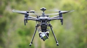
YellowScan, a global leader and designer of the next generation of manned and unmanned LiDAR solutions, announced the release of its new bathymetric system, the YellowScan Navigator, at CES 2024.
We have all witnessed the impact of climate change: drier and warmer seasons, interspersed by heavy rains and flooding rivers. These environmental hazards have an impact on human activities and infrastructure. Precisely mapping both waterbed and land is mandatory for monitoring, modeling, and mitigating coastal erosion, flood hazards and understanding biodiversity habitats.
YellowScan has pioneered the LiDAR mapping from drones since 2012, offering precise instruments that have improved many surveyors’ day-to-day operation. YellowScan constantly aims at developing outstanding products that address the evolving needs of the market. This year, YellowScan is excited to introduce the YellowScan Navigator, dedicated to fulfilling the crucial need of surveyors to map underwater topography, in rivers, ponds and coastal areas.
The YellowScan Navigator is an innovative bathymetric LiDAR solution. It features a laser scanner developed in-house over the last five years, and has been heavily tested to achieve optimal performance. This compact system is fine-tuned to map waterbeds within a depth range of 0 to 3 meters, but it reaches a depth of 18 meters in perfectly clear water conditions. It can be flown up to 100m above the water surface and provides measurements with a precision and accuracy of 3 centimeters. Additionally, a camera is embedded to provide true-color data colorization.