5 min read
Opinions expressed by Entrepreneur contributors are their own.
In this day and age, it can be hard to imagine life without the internet and our smartphones. Most of us depend on mobile apps daily. If you haven’t noticed, many of the apps you use request access to your geolocation to provide you with better services. This might become even more common in the future because geospatial technology is making leaps into integrating big data into software and technology with more practical daily uses.
Related: Cloud Architecture and Cloud Computing Trends in 2019
Geospatial analytics and data processing.
The geospatial business isn’t an easy one because, although maps and geographical images may be fun and useful, they aren’t the easiest to sell. Commercial adoption of geospatial technology has always been problematic due to incompatibility issues, such as data migration using old infrastructure to make them available to new services. Cloud storage has been the key in helping geospatial technology move forward, albeit gradually. The cloud’s ability to store and disseminate data has improved markedly compared to years before, allowing businesses to create products that can push information close to real-time. Products like the Geospatial Analytics InSite Suite of Solutions™ leverage the power of the cloud to help their clients in asset inspection and management, even if these assets are in several locations around the country.
Smart cities.
Cars have seen a great share of technological advancements through the years — think self-driving cars and Wi-Fi enabled cars with always-online HUD’s. What seems to be left to the wayside are asphalt roads. The exact definition of a smart city may be up to debate, but a common consensus, according to the Smart Cities Council, is that a smart city has “digital technology embedded across all city functions.” Base mapping is essential in creating sensory-enhanced urban areas that seamlessly integrate autonomous vehicle transportation, 3D technologies and asset management into a meaningful whole. It provides a means for intelligent travel and acts as a foundation from which a smart city can grow. Companies like Mapillary and Telensa have pioneered the use of geospatial technology to provide in-depth, real-time city imagery and sensors that monitor traffic and detect pollution.
Related: Why Smart Cities Are a Golden Opportunity for Entrepreneurs
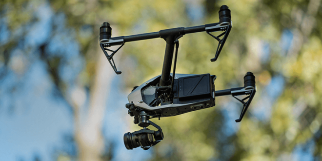
Unmanned Aircraft Systems (UAS).
Unmanned aircraft systems or drones are nothing new, but the technology that flies them is a different story. The coming year sees a rise in the use of UAS, with a focus on the production and use of high-quality engineering products that are ready to support current aerial metric mapping sensors. Their use has also gone beyond the military. Companies like Aerovironment, a world-leading manufacturer of military drones, are designing drones for commercial applications in the energy and agriculture sectors.
Mapping as a Service (MaaS).
Advancements in cloud data storage have brought about a variety of business models that have been and are being tested for the public scale and download of data via web-based portals. Google Maps can provide an overview of most areas around the globe, but companies like Nearmap provide high-resolution satellite imagery for nearly any location worldwide, on demand. This customized data can then be used for landscaping, engineering and even public safety. It takes just a few days for this data to be delivered, and this period will be shortened as this business model continues to grow in the coming year.
Related: In The Architectural Space, Bigger Isn’t Necessarily Better
Building Information Modelling (BIM).
Today, 3D technology is not only used in gaming design but also in supporting building information modelling (BIM). Combining geospatial technology with advances in computation enables more comprehensive analyses of the Earth’s surface, allowing for innovations in the A/E industry. Architects and engineers can use this data to come up with richer, more detailed models that will help in designing and facilitating smarter projects. In the future, geospatial technology-supported BIM can be further augmented by advances in the augmented reality (AR) and virtual reality (VR) spaces.
AEG firm Woolpert has recently joined hands with the Metropolitan Atlanta Rapid Transit Authority (MARTA) in the planning and construction of the Buckhead Station Pedestrian Bridge, which crosses an interstate to provide access to the station. In this project, Woolpert relied heavily on 3D laser scanning and point cloud data to create a realistic 3D visualization that was later used as a roadmap for the execution of the award-winning Atlanta project.
From simple wall scribbles and hand-drawn maps, technology has pushed mapping into the digital age with geospatial data and digital satellite imagery. Maps and navigation data can now be accessed almost instantly via computers and smartphones. Exciting enough as it is, the future looks brighter still for geospatial technology, and it’s truly something to watch out for in the coming year.


