A quarry, a prison site or a religious location? Purdue University engineering and liberal arts researchers are using drones to help answer the question about the past use of an island of Turkey.
Dana Island is located off the southern coast of Turkey. Many stories have been floating around regarding the history of the island, which is one reason researchers from Purdue’s College of Liberal Arts decided to explore the geography and artifacts from the island.
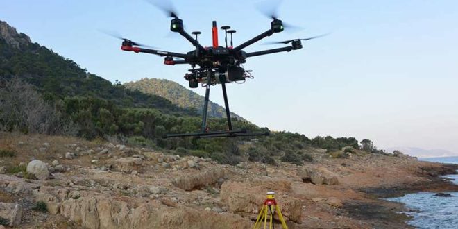
This past summer, a group from Purdue’s Lyles School of Civil Engineering joined the researchers on the island to use drones and LiDAR, light detection and ranging, mapping systems to better understand the island’s history. The work also is part of the College of Liberal Arts’ ROSETTA initiative, focused on remote sensing technologies and techniques in archaeo-anthropology. The initiative builds on the world reputation of CLA researchers in socio-human and remote sensing.
“We proved the high potential for our technology to be used for data collection for archaeological documentation,” said Ayman Habib, Purdue’s Thomas A. Page Professor of Civil Engineering and co-director of the Civil Engineering Center for Applications of UAS for a Sustainable Environment (CE- CAUSE). “We have opened the door to new and different methods and research problems in accurate mapping of real-world objects and locations.”
The team of engineers used the drone and system technology they created to do flyovers around the island and chart measurements from the LiDAR point clouds and aerial photographs. They are combining that work with the discovery of artifacts from the liberal arts researchers to put together historical information about the use of the island, where objects related to shipbuilding and quarries have been discovered.
“This was our most challenging work yet involving our drone and mapping systems,” Habib said. “We faced major challenges in getting the equipment to the island and then working around the dense vegetation and some snakes.”
Drones reveal secrets of ancient Florida village
Citation:
Drones, lasers to help unravel the mysteries of a Mediterranean island (2019, November 20)
retrieved 20 November 2019
from https://phys.org/news/2019-11-drones-lasers-unravel-mysteries-mediterranean.html
This document is subject to copyright. Apart from any fair dealing for the purpose of private study or research, no
part may be reproduced without the written permission. The content is provided for information purposes only.


