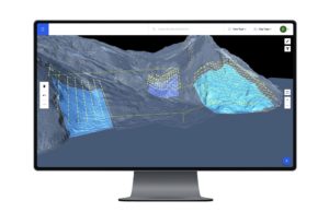
Source: Drone Harmony
Switzerland-based Drone Harmony is upgrading its line of terrain aware flight planning platforms to better account for differences in elevation – a key requirement in many industries from surveying to mining inspection.
Several drone systems gather 3D data geographic data for analysis and, with this growth, the availability and use of terrain data is expanding quickly. Drone Deploy’s new upgrade offers automated terrain-aware missions planning by using both custom terrain maps, as well as the newly integrated Airbus 12-meter grid global data set.
“Customers that do not have custom terrain can profit from a global source of accurate terrain data without ever leaving the Drone Harmony application,” a Drone Harmony spokesperson said. “With a few clicks in the web interface, customers can pull terrain data anywhere in the world and start planning missions.”
The upgraded platform also boasts a combination of flexible import options together with 3D DEM view and a rich new plan catalog for terrain aware flight planning.
“Drone Harmony Web makes it the most comprehensive tool for mapping and inspection in complex terrains. Furthermore, larger organizations with massive amounts of terrain data can profit from a built-in terrain streaming feature in Drone Harmony Web. This feature enables such customers to work with huge terrain models hassle-free, without the need to load terrain models in parts and worry about memory and processing limits.”
Past Success
Last year, Drone Harmony joined the ESA Business Incubator Switzerland, allowing the start-up to upgrade its UAS missions-planning platforms using satellite data.
In 2018, the company developed Cell Tower Scan, an Android app that uses the company’s UAV planning framework to complete cell-tower inspections in 5-10 minutes using quadcopters.
Drone Harmony works with several industry partners on drone workflow automation for various industrial use cases, including Bentley System’s Reality Modelling team, SiteSee (AUS), The iGlobe Group (RSA), VertSpec (USA) and EasyInspect (Denmark), as well as dozens of customers and resellers around the world.
Drone Harmony works with several industry partners on drone workflow automation for various industrial use cases, including Bentley System’s Reality Modelling team, SiteSee (AUS), The iGlobe Group (RSA), VertSpec (USA) and EasyInspect (Denmark), as well as dozens of customers and resellers around the world.
Jason is a longstanding contributor to DroneLife with an avid interest in all things tech. He focuses on anti-drone technologies and the public safety sector; police, fire, and search and rescue.
Beginning his career as a journalist in 1996, Jason has since written and edited thousands of engaging news articles, blog posts, press releases and online content.
Email Jason
TWITTER:@JasonPReagan
Subscribe to DroneLife here.
https://dronelife.com/2020/08/05/drone-harmony-upgrade-terrain-aware-platforms/
 Unmanned Aerial Vehicle The latest drone news

