

French drone company Delair is digging up a lucrative agreement with global mining group Eramet to deploy UAV data solutions.
The partnership will allow Eramet to access Delair Aerial Intelligence, a collaborative, drone-data platform that crunches aerial data into valuable business-facing insights.
Launched in January, the platform provides custom analytic models for industries such as mining, construction, and agriculture to enable more accuracy and precision to deliver bottom-line benefits.
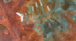
Delair.ai has been up and running at Eramet’s Tiébaghi mine in New Caledonia for several months and, by the end of the year, it will be used by all of the group’s mines. Nine drones are currently in operation with an additional nine planned for deployment by the end of this year, including Delair’s fixed-wing UX11 drone. Eramet will be able to map and analyze around 300,000 hectares a year across all sites.
A company statement notes:
“Combining methods which are five times faster than traditional ways of working with centimeter-level accuracy in drone data collection, Eramet is able to optimize its mining operations, reduce costs and improve the safety of topographers. Using artificial intelligence-based analytics allows the Group to continually measure and update distances, surface areas, volumes and slopes. Interactive and scalable, the Delair.ai platform allows for data to be securely and easily exchanged, providing a convenient space to collaborate, communicate instructions, manage subcontractors, and store information on the Cloud. With this platform in place, it is now possible for Eramet to manage its mining operations in real time, in line with its strategic goals.”
Earlier this year, Delair released new integration features to its Trimble Business Center software. The integration enables geospatial professionals to drag and drop data from the Delair UX11 PPK drone system directly into Trimble Business Center projects.
In November, Delair introduced a new drone model focused on the agriculture industry — the UX11-Ag. Built on the UX11 fixed-wing drone footprint, the new version combines the productivity benefits of long-range/BVLOS flight operations with highly accurate survey-grade mapping and plant data collection capabilities.


Jason is a longstanding contributor to DroneLife with an avid interest in all things tech. He focuses on anti-drone technologies and the public safety sector; police, fire, and search and rescue.
Beginning his career as a journalist in 1996, Jason has since written and edited thousands of engaging news articles, blog posts, press releases and online content.
Email Jason
TWITTER:@JasonPReagan
Subscribe to DroneLife here.
https://dronelife.com/2019/06/26/delair-digs-up-new-drone-mining-client/


