
Cansel, a leading technology solutions provider for industries including engineering, surveying, construction, and utilities, announced a partnership with GeoCue, a global provider of 3D LiDAR imaging sensors and geospatial software. Now as a distributor of GeoCue, Cansel will offer the full product line of TrueView LiDAR 3D imaging sensors and LP360 processing software throughout Canada.
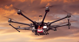
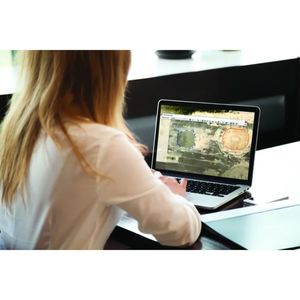
TrueView is an innovative drone LiDAR and photogrammetry solution integrated into lightweight payloads, allowing for fast, easily automated generation of true 3D colourized point clouds, oblique imagery, and orthophotos from a single drone flight. LP360 is an advanced desktop LIDAR software package that makes easy work of extracting information and generating deliverables in an intuitive GIS environment.
“Cansel is committed to providing our customers with the highest quality, leading-edge technology,” said Martin Trudelle, Cansel’s CEO and President. “That is why we’ve partnered with GeoCue, a company that shares our commitment to excellence. We know that our customers can trust that GeoCue’s products and software meet our rigorous standards, and we’re confident that this partnership will help us exceed their expectations.”
According to Vincent Legrand, Vice President, Global Sales at GeoCue, his company builds partnerships with distributors who have high standards of excellence. “With Cansel’s proven track record in technology solutions, we can both maintain our focus on innovation and growth while achieving superior results for our valued customers.”
Mike Hogan, Cansel’s 3D Reality Capture Segment Manager, leads the charge of helping clients capture, transform, and manage data. “The products and software available from GeoCue are a very good fit for our surveying customers,” Hogan said. “Together with the support of our professional services team, we’ll help our customers onboard these products, add them into their workflows, and employ these tools to grow their business.”
Kris Kelly, the GeoCue regional sales manager for Canada, is excited about the opportunity to grow the TrueView and LP360 footprint throughout Canada and California. “Cansel’s team of geospatial professionals has years of surveying and engineering experience,” said Kelly. “They also have a deep understanding of the applications for GeoCue’s LiDAR technology and software. This makes them an ideal partner to reach new customers and meet their geospatial needs.”
More information about the TrueView product line and LP360 software is now available on the Cansel website. Cansel is also a Gold sponsor for this year’s LiDAR CANEX, a virtual B2B event matching reality capture lidar vendors with practicing 3D professionals from Canada and beyond. TrueView products GeoCue will be featured in presentations and workshops for the event on April 25th and 26th.
About Cansel
Cansel helps clients capture, transform, and manage data leading to increased field-to-finish efficiency and profitability. For over 50 years, Cansel has provided field technology solutions for industry professionals in the engineering, surveying, construction, mining, utilities, forestry, and government sectors. The company is headquartered in Burnaby, BC, Canada.
Learn more at www.cansel.ca.