4:37 pm
airspace security, Commercial Drones, DJI, Drone, LATAS, News, PrecisionHawk, UTM
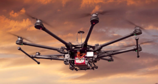
The following is press release from PrecisionHawk. PrecisionHawk’s Low Altitude Traffic and Airspace Safety (LATAS) platform to replace AirMap PrecisionHawk, Inc. today announced a partnership with DJI, the world’s leader in civilian drones and aerial imaging technology, to improve its geofencing technology. Leveraging PrecisionHawk’s Low Altitude Traffic and Airspace Safety …
Read More »
12:37 pm
AirMap, DJI, Drone, Drone News Feeds, Feature 1, GEO, geospatial data, News, PrecisionHawk
DJI has announced improvements to its geofencing technology. The move will refine airspace limitations for drone flights near airports to provide better protection to airplanes in sensitive areas. The GEO update will be backed by geospatial data from PrecisionHawk, replacing Airmap, the Santa Monica-based company DJI had been working with since …
Read More »
6:38 pm
Drone
Next generation drone comm-link delivers nationwide range and collision warning DALLAS (PRWEB) October 23, 2018 Big names in telecommunications have been quietly partnering with a hardware enabled network services startup called SqwaQ. Its patented technology promises to transition the drone industry not just beyond line-of-sight, but beyond city, county and …
Read More »
8:29 am
Amazing Footage, deer, Drone, Drone News Feeds, Drones in the News, Enthusiasts, Lincolnshire, News, Poaching, Police, Video
The UK is famous for many things but an abundance of exotic wildlife isn’t one of them. Which means the police have to take special measures to keep what little they do have intact. Lincolnshire Police have a fleet of drones to help with event security, tactical operations and more. …
Read More »
8:26 pm
BSHARK, Drone, hydrogen Drone, inspection drone, Narwhal 2, News, Sponsored Content
In the first week of production, BSHARK’s Narwhal 2 hydrogen drone sold 300 units, prompting the company to open a new production center in Shandong to meet demand. The Government of Uzbekistan has bought hundreds of units. China’s Southern Power Grid Company is using the Narwhal 2 to complete major …
Read More »
4:25 pm
Drone, Drone News, Drone News Feeds, Embry-Riddle Aeronautical University, News, UTM
A recent study reveals that a growing number of amateur drone users are creating new dangers with risky flights. Florida-based Embry-Riddle Aeronautical University released the study this week estimating that “only 12 percent of all detected drones were flying near unimproved land and parks.” “More than three-fourths were flying in …
Read More »
8:23 am
Business and Finance, Drone, Drone News Feeds, dronesense, emergency, Featured – Safety and Security, First Responders, flir, News, Products, Search and Rescue, software platform, Technology
Thermal imaging specialists FLIR Systems have plenty of interest in the drone industry, particularly when it comes to public safety. The Oregon-based company partnered with DJI earlier this year to launch the Zenmuse XT2, a dual optical and thermal camera designed to support firefighters and first responders. Now the company …
Read More »
4:22 am
Black Hornet, Defense, Drone, Drone News, Drone News Feeds, flir, nano-drones, News
Military and emergency agencies may find the biggest aerial solutions are found in the smallest packages after the launch of new nano-drone system by an Oregon-based UAV firm. FLIR Systems recently developed the Black Hornet 3 nano-unmanned aerial vehicle – a new member of its Black Hornet Vehicle Reconnaissance System. …
Read More »
4:20 pm
Drone
Unmanned Systems Army looks into laser-powered drones By Matt Leonard Sep 05, 2018
Even as drone technology advances, power constraints limit the amount of equipment unmanned systems can carry as well as the time they can stay in the air. Some drone systems, like the Persistent Aerial Reconnaissance and …
Read More »
12:28 pm
Drone
Joe Sterling has spent 36 years as a volunteer with the Leesburg Fire Department, but he’s recently taken on a new title — the township’s very own licensed drone pilot. The township is the first in Cumberland County to have a drone team ready to respond to emergencies. The $9,400 …
Read More »