Bangalore has been synonymous with having chronically bad traffic, but the recent rains have made matters worse. The city’s poor infrastructure has been exposed and there’s no going back. The Silicon Valley of India drowned and boats had to be deployed to rescue citizens from submerged societies. It has been a difficult few days.
To make things worse, millions in productivity have been lost due to Bangalore’s crumbling infrastructure. According to Outer Ring Road Companies Association (ORRCA), IT companies in the city lost over $28 million (INR 225 crore) in a single day on August 30, 2022, as the employees were stuck in traffic jams for over five hours.
Unfortunately, Bangalore is not alone. According to UNICEF, India is among the world’s most disaster-prone countries with 27 of its 29 states and seven union territories exposed to recurrent natural hazards such as cyclones, earthquakes, landslides, floods, and droughts.
Why are Indian cities prone to flooding? Who is responsible for these disasters? While the debate goes on, it is important to now focus on technological initiatives that can detect natural calamities, facilitate effective disaster management and help citizens in such situations.
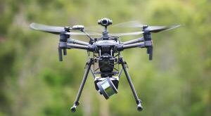
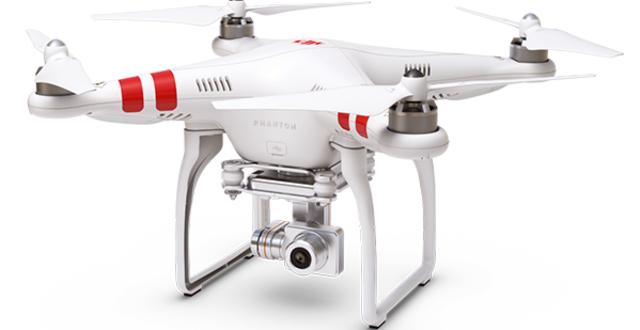
Here’s where drone surveillance comes into the picture. Drone technology gives us a tactical edge and aids us in staying ahead of irreparable damage. They can be leveraged pre-disaster (mapping risk profiles and identification) as well as post-disaster (risk mitigation and rescue).
AI predicts what humans cannot
Artificial intelligence can analyse data to track patterns and weather changes. It can also use geological information to predict tsunami warnings, wildfires, and earthquakes and identify weak points in infrastructures. Such reliable databases are crucial in taking the right steps such as evacuation and helping with better management of resources. Patterns can be detected with geographic data, satellite imagery, and real-time seismic data. India needs a roadmap to deploy AI for effective adoption and implementation.
Drone applications for disaster management
According to research, the UAV drone market is expected to generate a revenue of USD 72.1 Billion in 2030, globally, at a 17.22% CAGR.
- Real-time mapping: Areas prone to disasters on a large-scale benefit highly from 3D mapping and visual imaging. Using drones provides a cost advantage and has a faster response time when compared to traditional methods such as manned aircraft and satellite mapping. By identifying hotspot areas with the most damage, drones can upload all information in real time and help rescue and relief operations. Drones assisted during the 2015 Nepal earthquake by creating 3D maps.
- Managing wildfires: Forest fires commonly occur during and after disasters. To fight wildfires, pilots must fly at low altitudes. However, that can become extremely dangerous amidst high temperatures and dangerous winds. Drones can eliminate these risks and increase the effectiveness of battling wildfires. With communication systems, drones can ensure contact between teams and facilitate safety.
- Remote assessments: The swift maneuverability of drones can survey disaster zones and carry out remote assessments. Disasters are typically gigantic in scale and the adaptability of UAVs can provide a better view of the overall situation. High-res cameras can take sharp pictures and collect relevant information, which then helps the governments and disaster relief teams to make decisions. Just this year, the South African National Defence Force (SANDF) used drones to gather intelligence and capture photographs to assess flood-damaged areas.
- Delivering urgent supplies: Citizens may need a disaster supply kit or some emergency supplies to survive. It encompasses first aid, medicines, ropes, flashlights, food, water, etc. Drones can deliver such supplies to the remotest of areas till the situation is under control. During the pandemic, drones were used to deliver PPE supplies and Covid test kits in remote Scottish Highlands.
- Drone-led search and rescue (SAR): Search and rescue missions are typically human-centric, but recent times have warranted the need for autonomous systems. Helping the injured and wounded is a significant step in providing relief during disasters. Using unmanned aerial vehicles facilitates reaching areas that may be unreachable and invisible. More significant drone variants, such as hexacopters, quadcopters, and fixed-wing drones are equipped to carry human beings. This way, immediate first aid can be provided to the injured, infants, senior citizens, and pregnant women. Drones have complete movement and can aid in search and rescue operations much faster. Thermal imaging cameras can be used to identify people who are alive under all the debris.
Time to unleash autonomous drones for disaster management
The role of drones is expanding. In furtherance to military and commercial applications, drones are now increasingly being used for disaster management operations.
Today, for the Indian government, disaster management is one of the heaviest burdens. Drones have immense potential and can carry out safety procedures including 3D mapping, GPS tracking, aerial monitoring, and so much more.
UAV technology is changing the way the world operates. The crux of this discussion is that we need to invest in drones to boost disaster response and SAR. Period!
Disclaimer
Views expressed above are the author’s own.
END OF ARTICLE