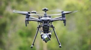
Airspace drone management firm AirMap announced the release of Real-Time Geofencing Alerts in the AirMap for Drones mobile app on iOS and Android.
“Available for free, the feature alerts pilots of their DJI drone’s in-flight positioning and offers a visual and/or verbal alert when their aircraft approaches airspace that is unsafe for drone operations. Additionally, AirMap Real-Time Geofencing Alerts are also available to developer partners and OEMs via a mobile SDK for iOS and Android.”
AirMap partners with “civil aviation authorities, air navigation service providers, and local authorities to implement an airspace management system that supports and enforces secure and responsible access to low-altitude airspace for drones.”
Real-Time Geofencing Alerts will soon be able to go beyond just alerts, with the ability to prevent drones from entering an unsafe operating area or veering off a planned flight path, if the pilot has opted in.
AirMap Real-Time Geofencing Alerts are also available to developer partners and OEMs via a mobile SDK for Android and Swift (iOS) delivering airspace environment status information relative to the UAS flight path.
By integrating AirMap Real-Time Geofencing Alerts in their UAS applications, AirMap developers will be able “to build services enhancing flight safety, compliance and overall experience for their users,” like preventing drone operators from flying into airspace that is regulated or restricted, ensuring conformance of flight paths, or geotagging a drone’s operation within a defined airspace polygon, while leaving the ultimate control of the done to their users as needed.
Real-Time Geofencing Alerts are available today in the AirMap for Drones mobile application on iOS and Android. Real-Time Geofencing Alerts is only available for operators of DJI drones with the AirMap for Drones fly mode.
Earlier this month, Microsoft Azure announced that AirMap has selected Microsoft Azure as the company’s exclusive cloud-computing platform for its drone traffic management platform and developer ecosystem.
In August, AirMap partnered with Swiss air navigation provider Skyguide to build Europe’s first national UTM system in Switzerland, referred to as U-space.
Jason is a longstanding contributor to DroneLife with an avid interest in all things tech. He focuses on anti-drone technologies and the public safety sector; police, fire, and search and rescue.
Beginning his career as a journalist in 1996, Jason has since written and edited thousands of engaging news articles, blog posts, press releases and online content.
Email Jason
TWITTER:@JasonPReagan
Subscribe to DroneLife here.
https://dronelife.com/2018/12/09/airmap-releases-real-time-geofencing-alerts-in-upgraded-drone-app/